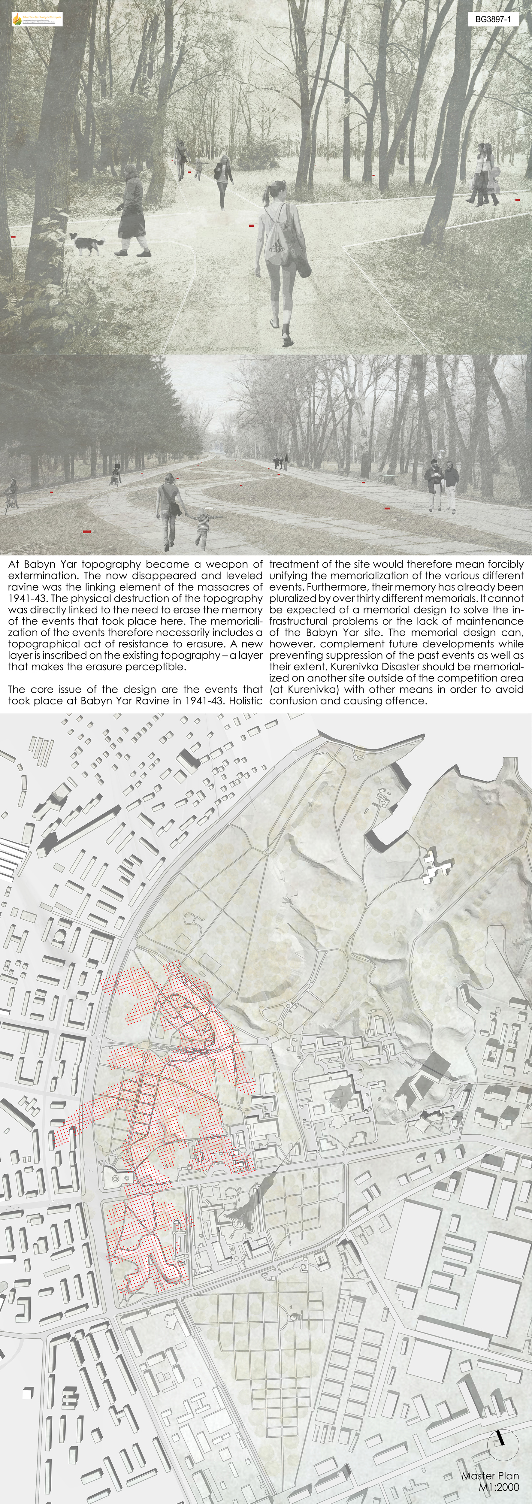
At Babyn Yar, topography became a weapon of extermination. The now disappeared and leveled ravine was the linking element of the massacres of 1941‐43. The physical destruction of the topography was directly linked to the need to erase the memory of the events that took place here. The memorialization of the events therefore necessarily includes a topographical act of resistance to erasure. A new layer is inscribed on the existing topography – a layer that makes the erasure perceptible.
The core issue of the design are the events that took place at Babyn Yar Ravine in 1941‐43. Holistic treatment of the site would therefore mean forcibly unifying the memorialization of the various different events. Furthermore, their memory has already been pluralized by over thirty different memorials. It cannot be expected of a memorial design to solve the infrastructural problems or the lack of maintenance of the Babyn Yar site. The memorial design can, however, complement future developments while preventing suppression of the past events as well as their extent. Kurenivka Disaster should be memorialized on another site outside of the competition area (at Kurenivka) with other means in order to avoid confusion and causing offence.
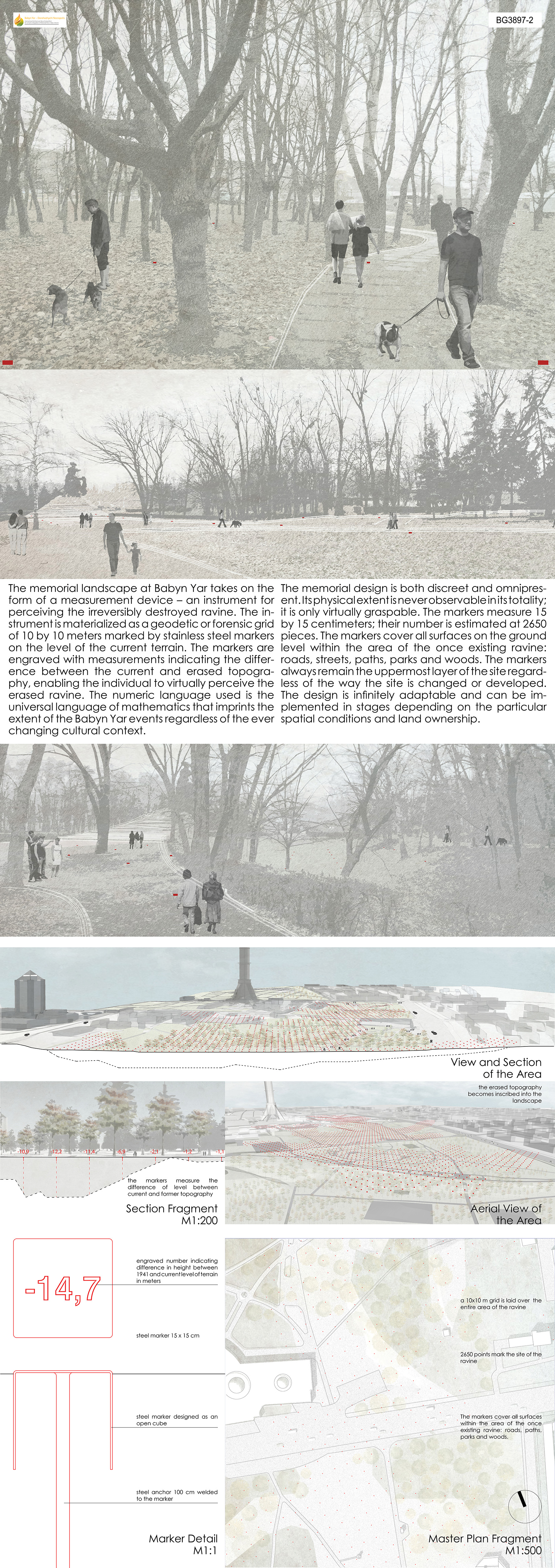
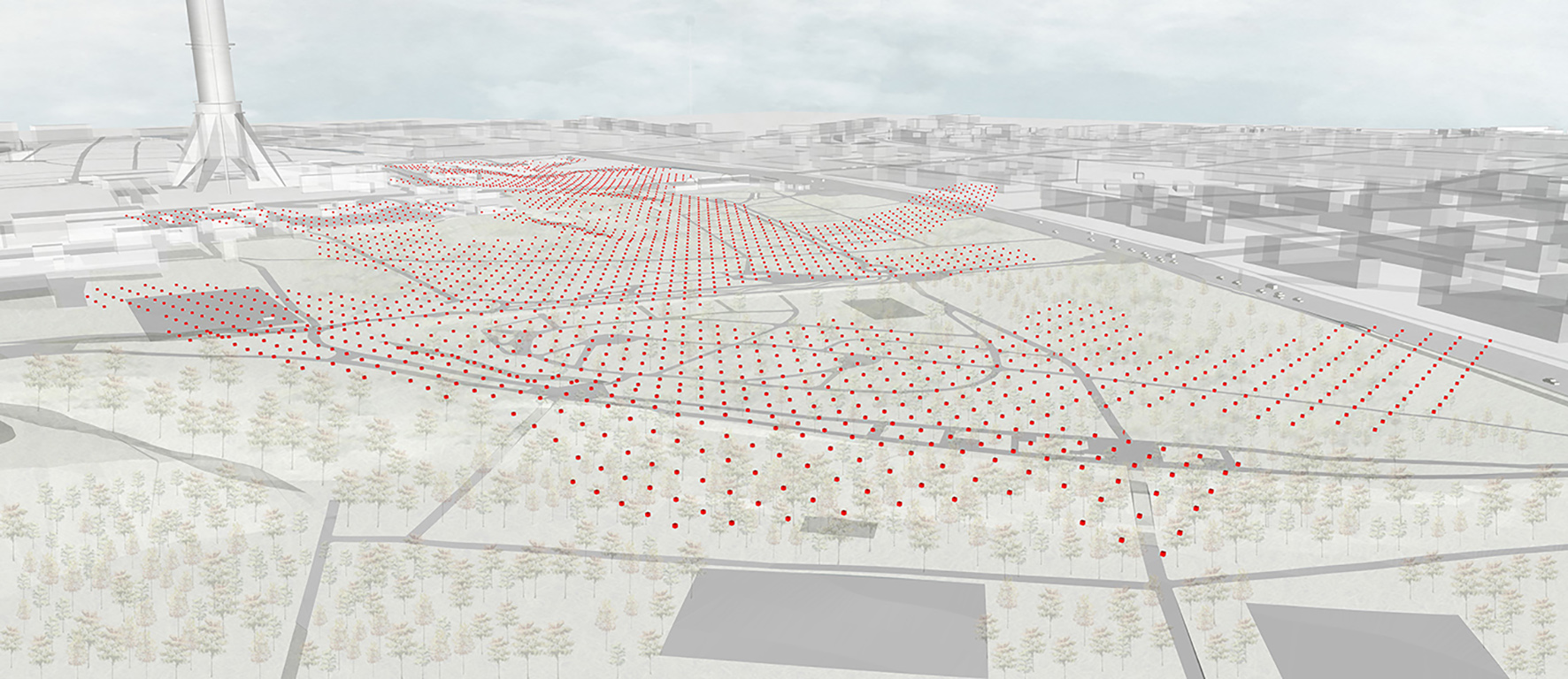
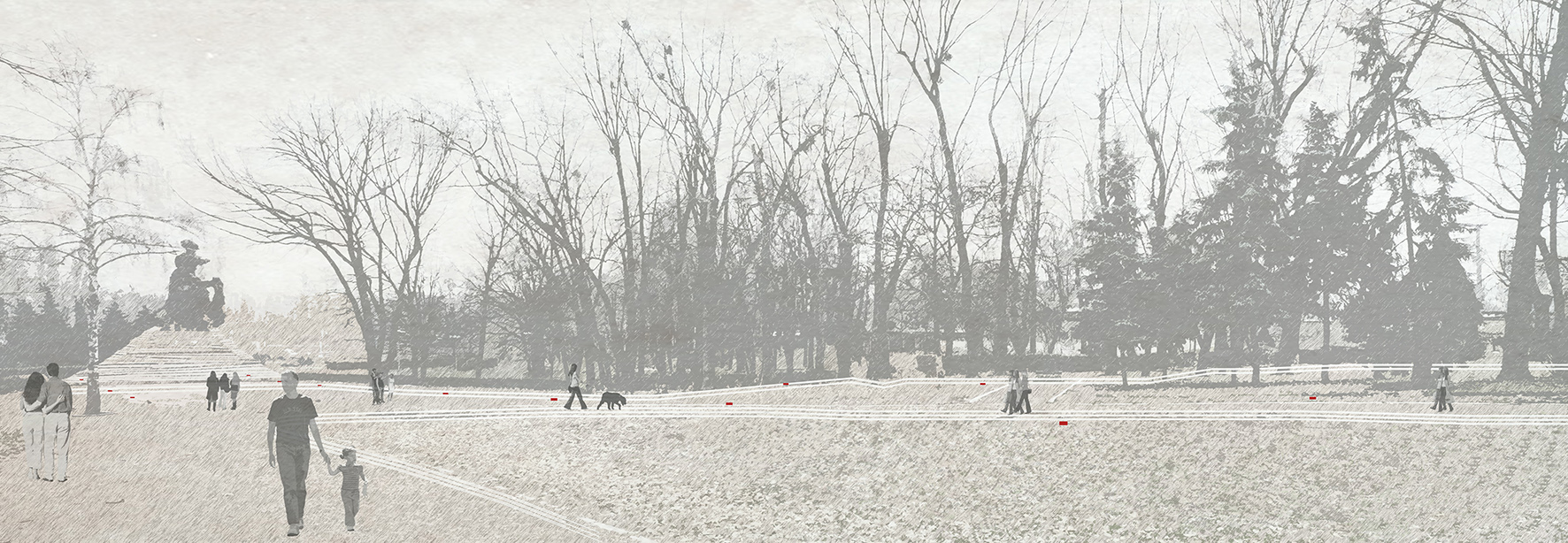
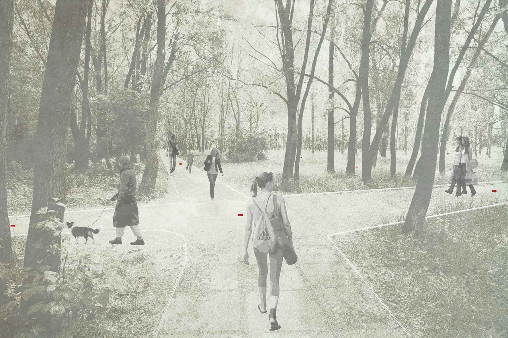
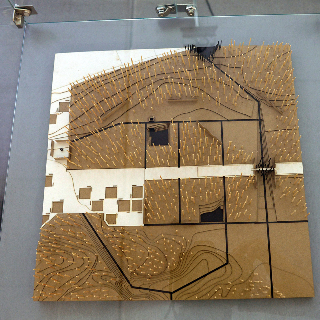
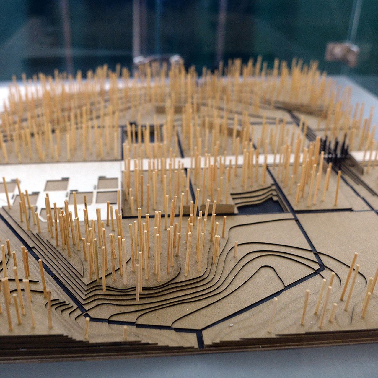
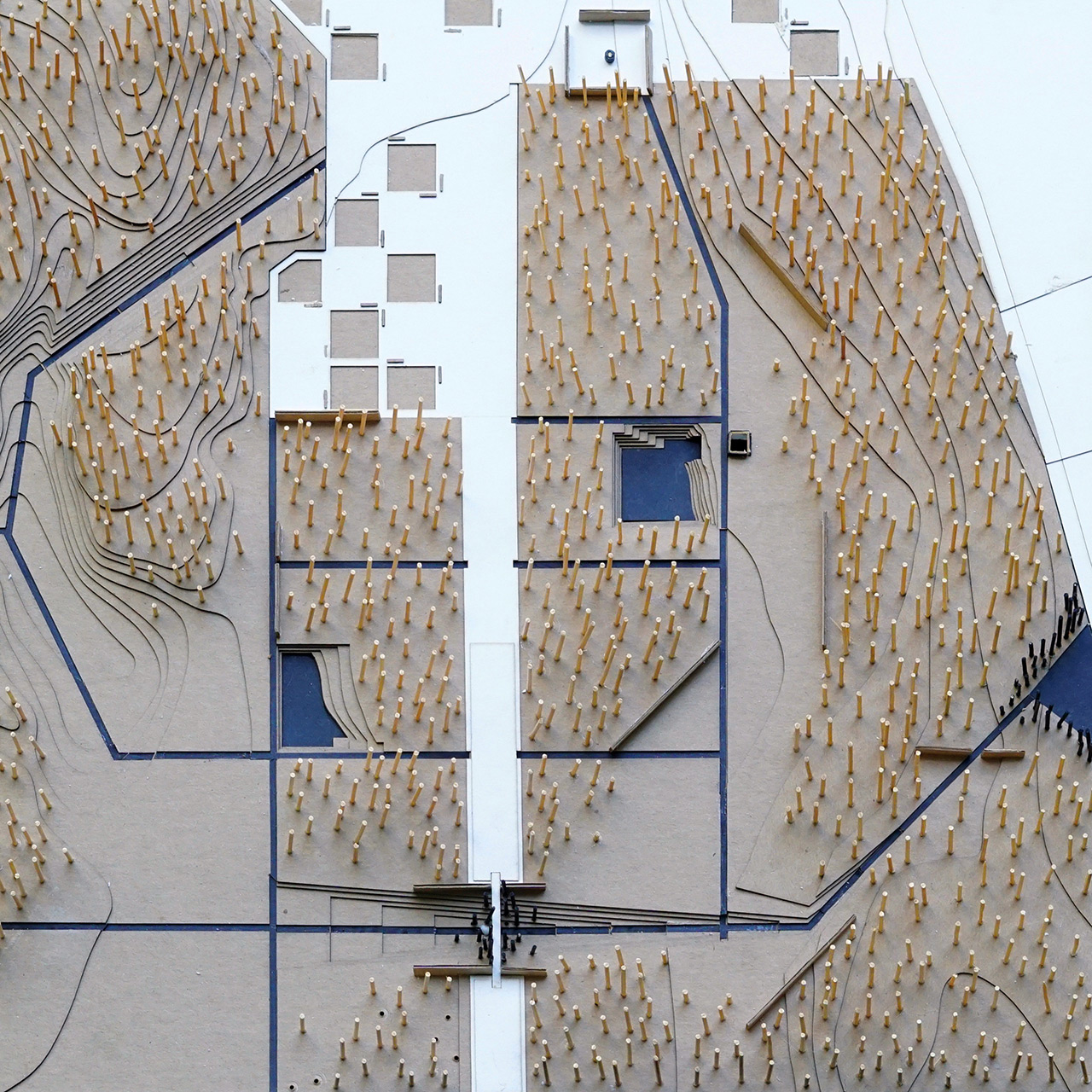
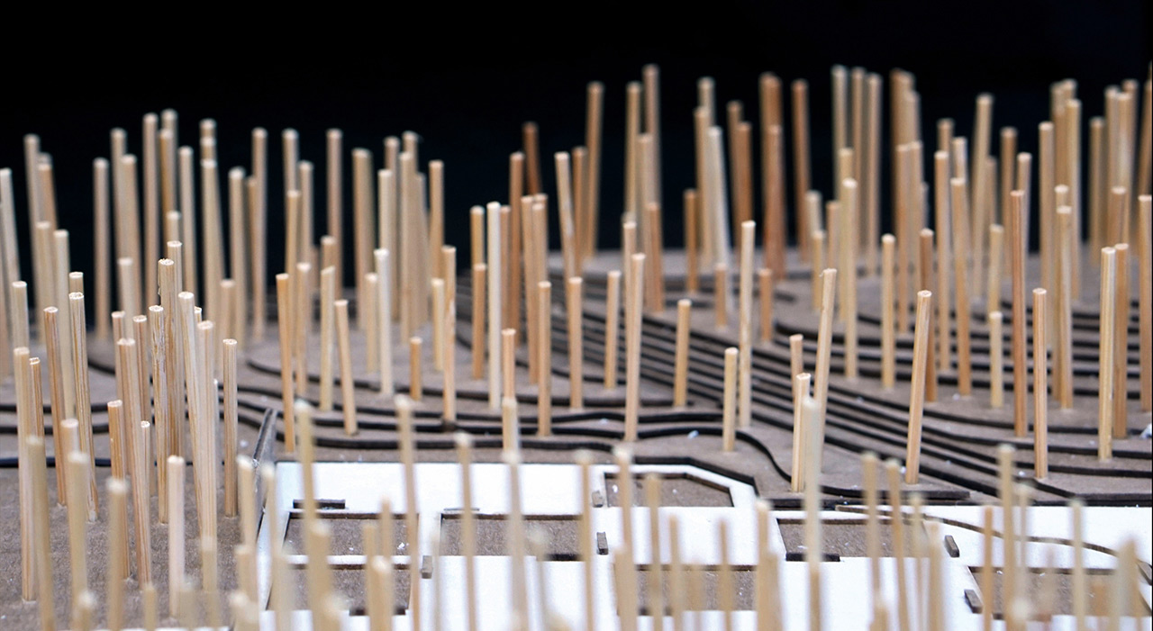
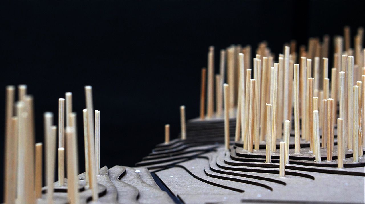
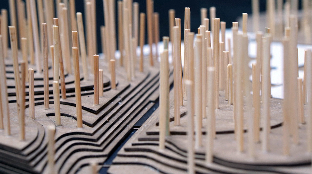
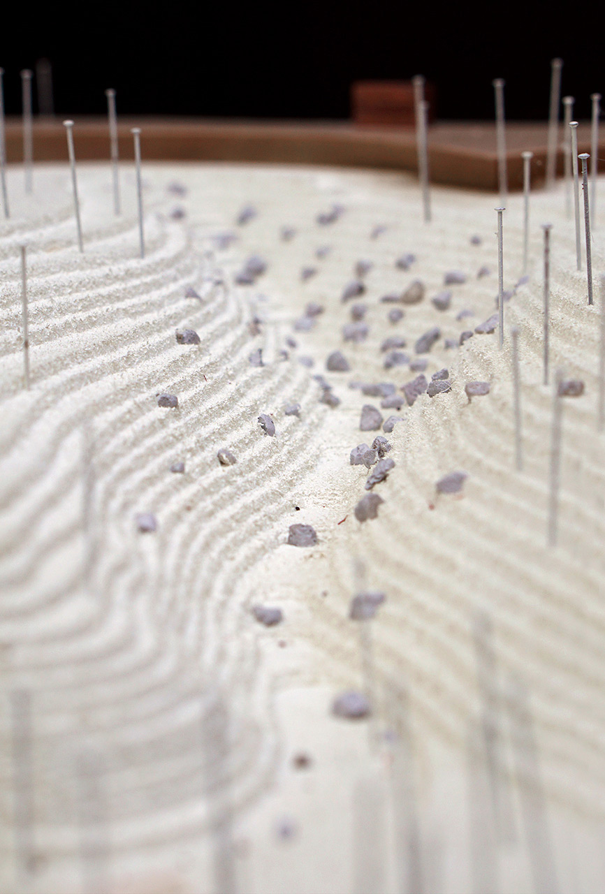
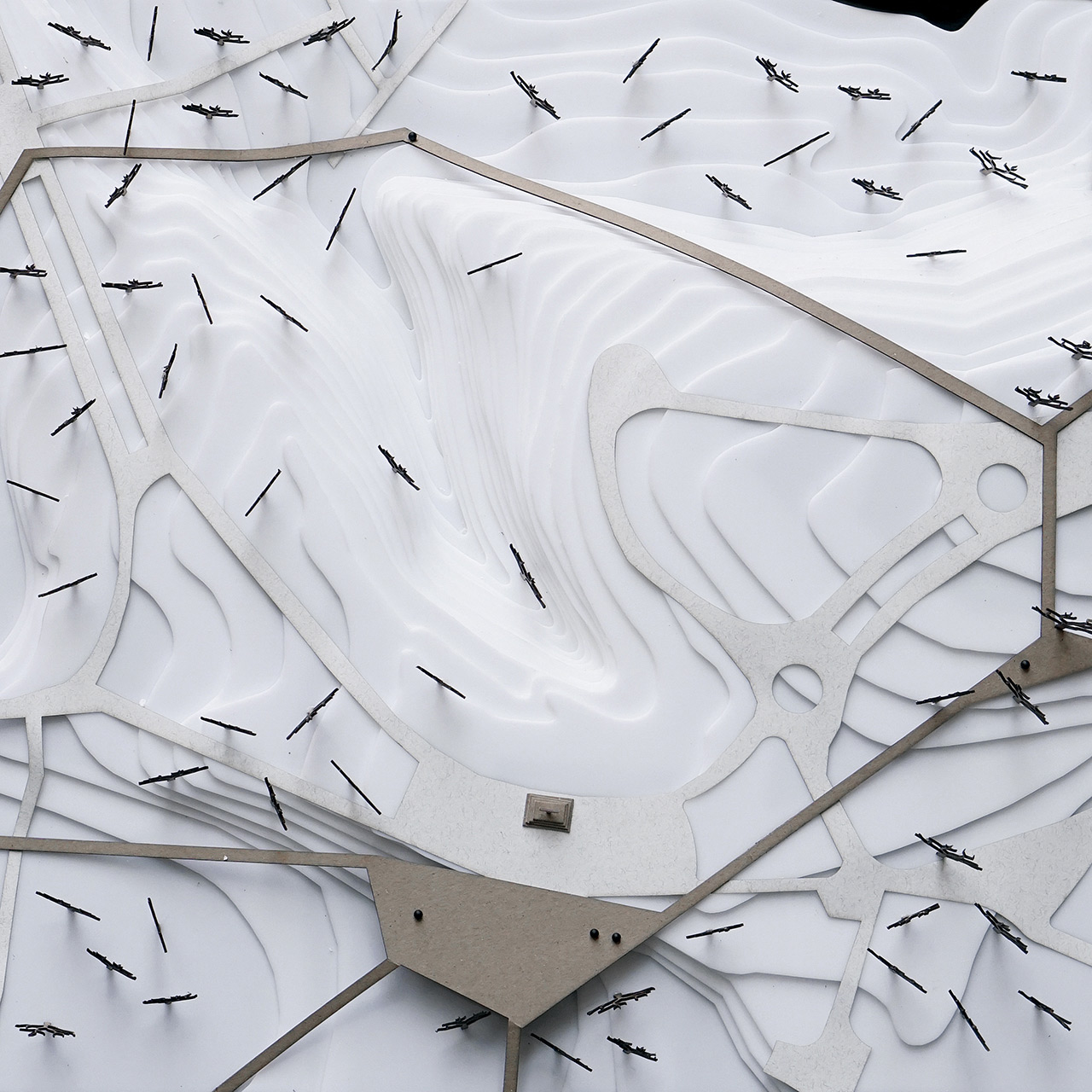
The memorial landscape at Babyn Yar takes on the form of a measurement device – an instrument for perceiving the irreversibly destroyed ravine. The instrument is materialized as a geodetic or forensic grid of 10 by 10 meters marked by stainless steel markers on the level of the current terrain. The markers are engraved with measurements indicating the difference between the current and erased topography, enabling the individual to virtually perceive the erased ravine. The numeric language used is the universal language of mathematics that imprints the extent of the Babyn Yar events regardless of the ever changing cultural context.
The memorial design is both discreet and omnipresent. Its physical extent is never observable in its totality; it is only virtually graspable. The markers measure 15 by 15 centimeters; their number is estimated at 2650 pieces. The markers cover all surfaces on the ground level within the area of the once existing ravine: roads, streets, paths, parks and woods. The markers always remain the uppermost layer of the site regardless of the way the site is changed or developed. The design is infinitely adaptable and can be implemented in stages depending on the particular spatial conditions and land ownership.
Autors:
Jana Petkovic — Architect — Lubliana, Slovenia
Nejc Lebar — Architect — Lubliana, Slovenia
Maja Valentic — Architect — Lubliana, Slovenia
Milos Kosec — Architect — Lubliana, Slovenia

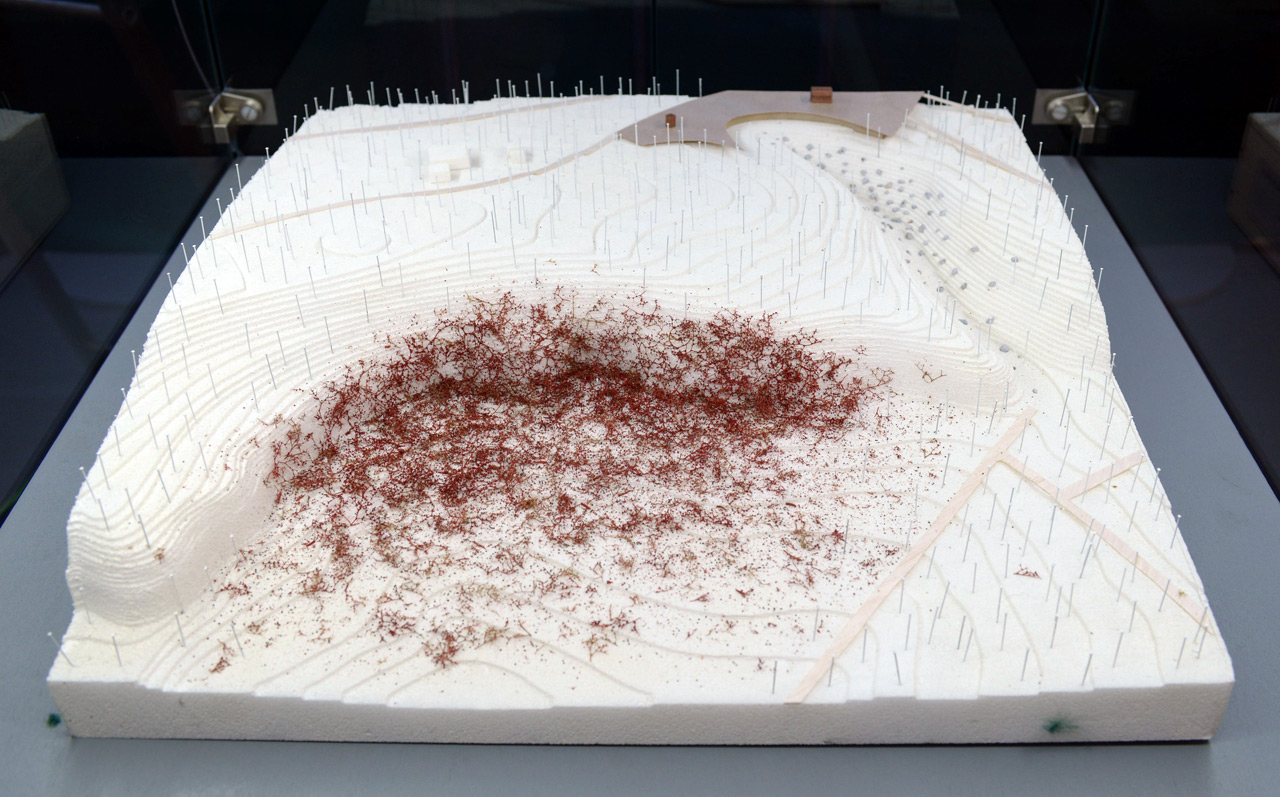
Model:

Published: 2016-06-07

Babyn Yar park
Fragments of a memory in motion
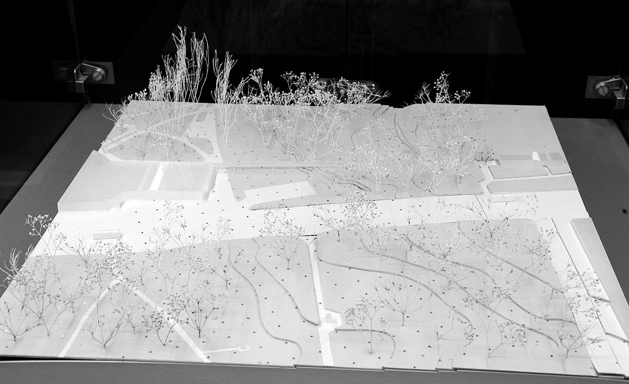
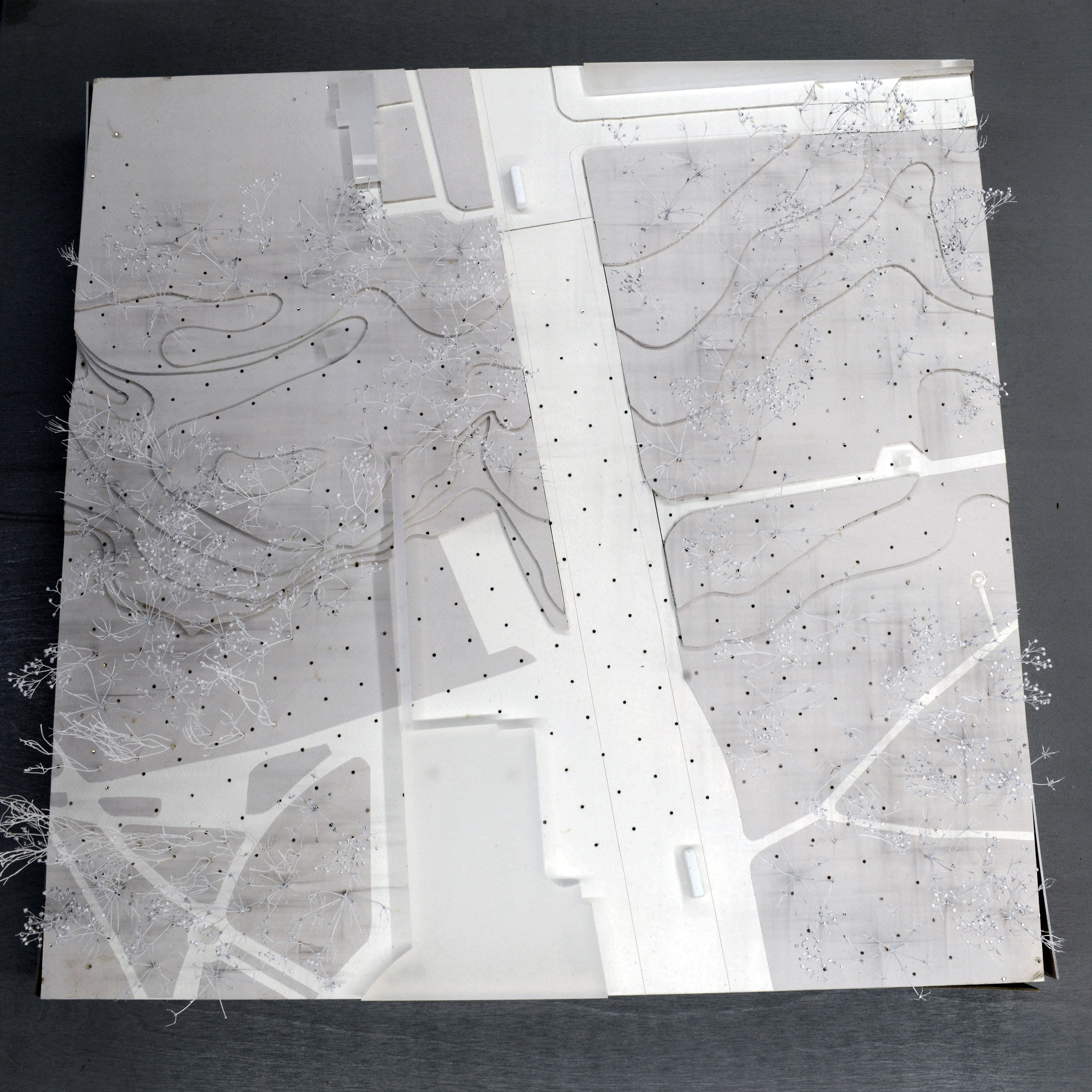
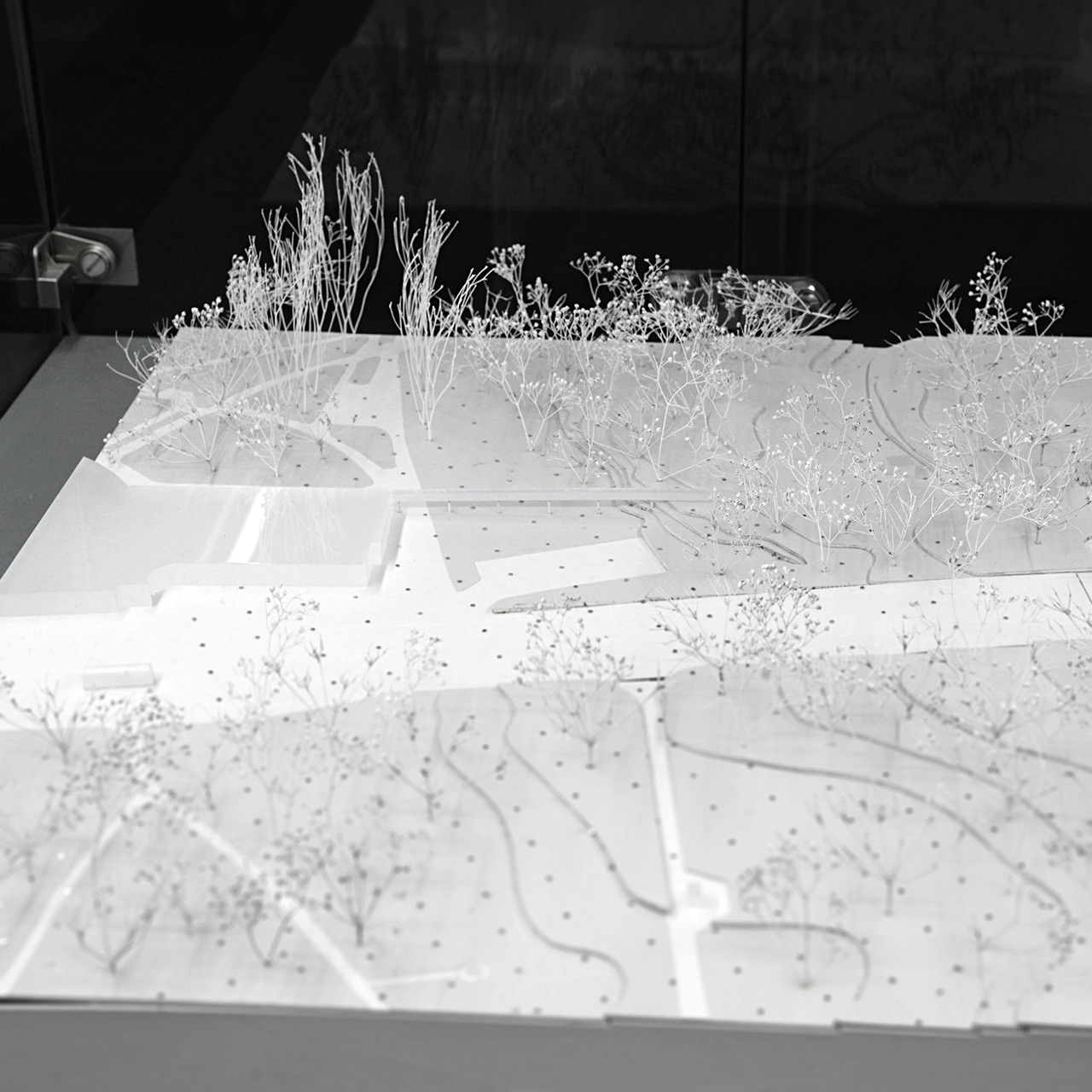
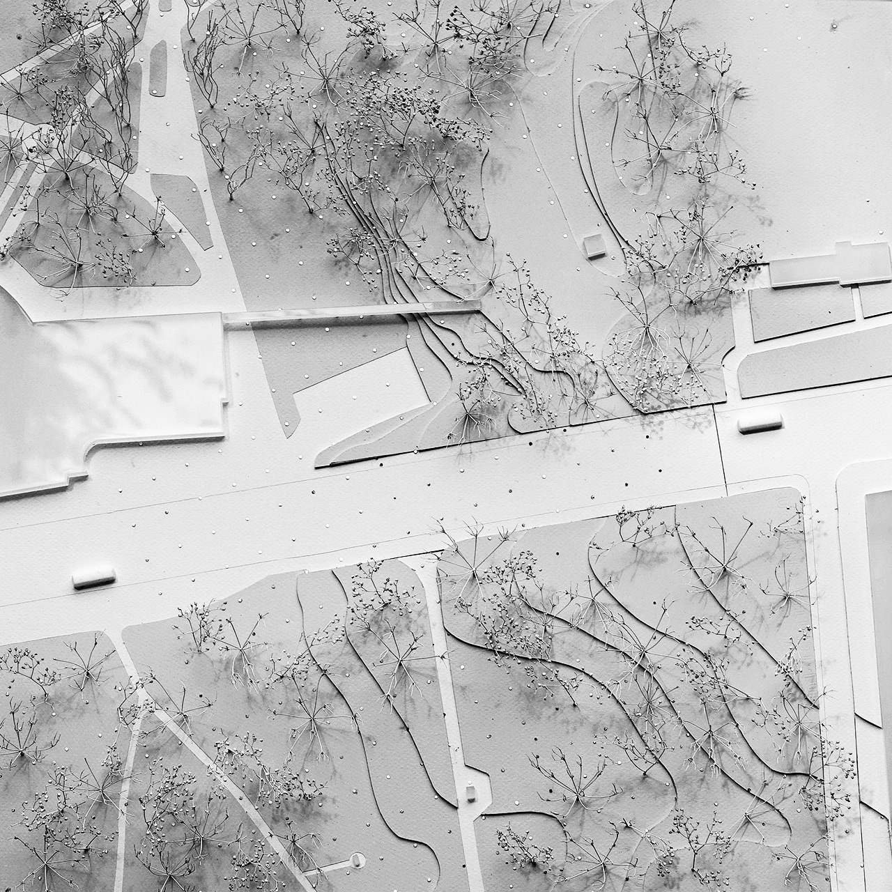
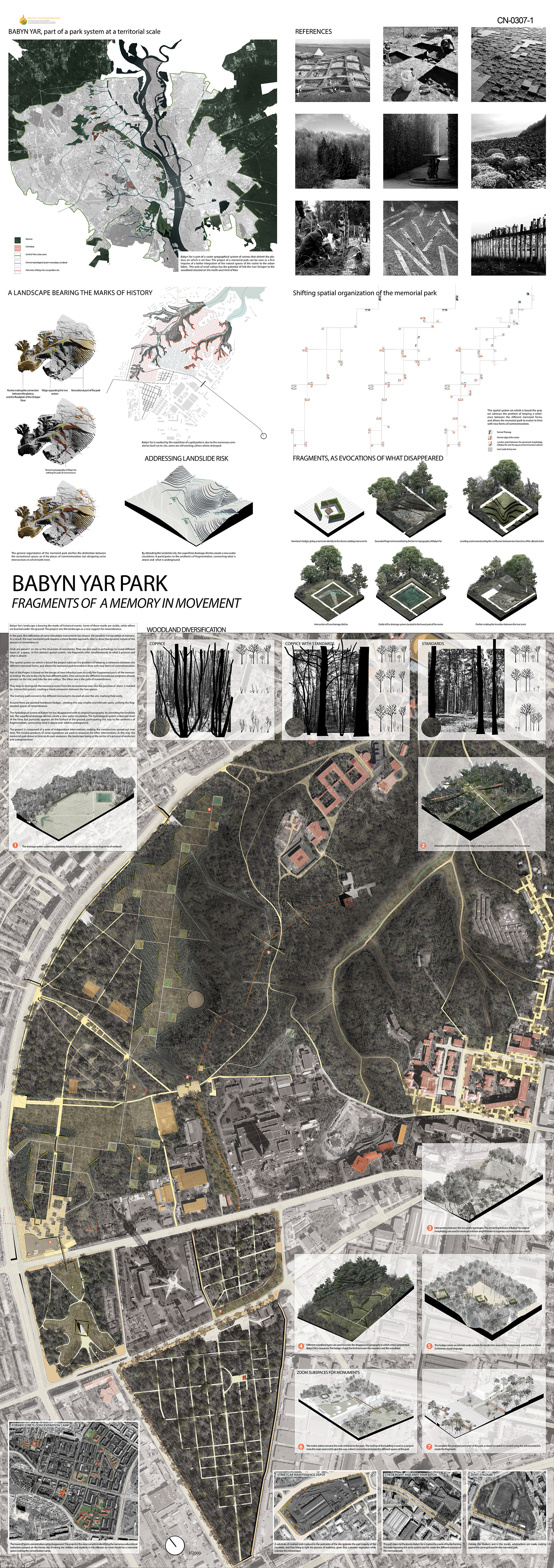
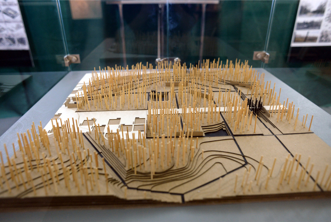
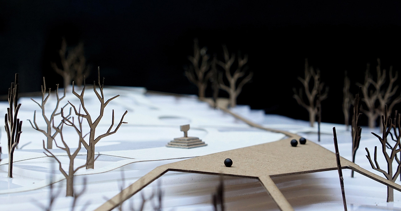
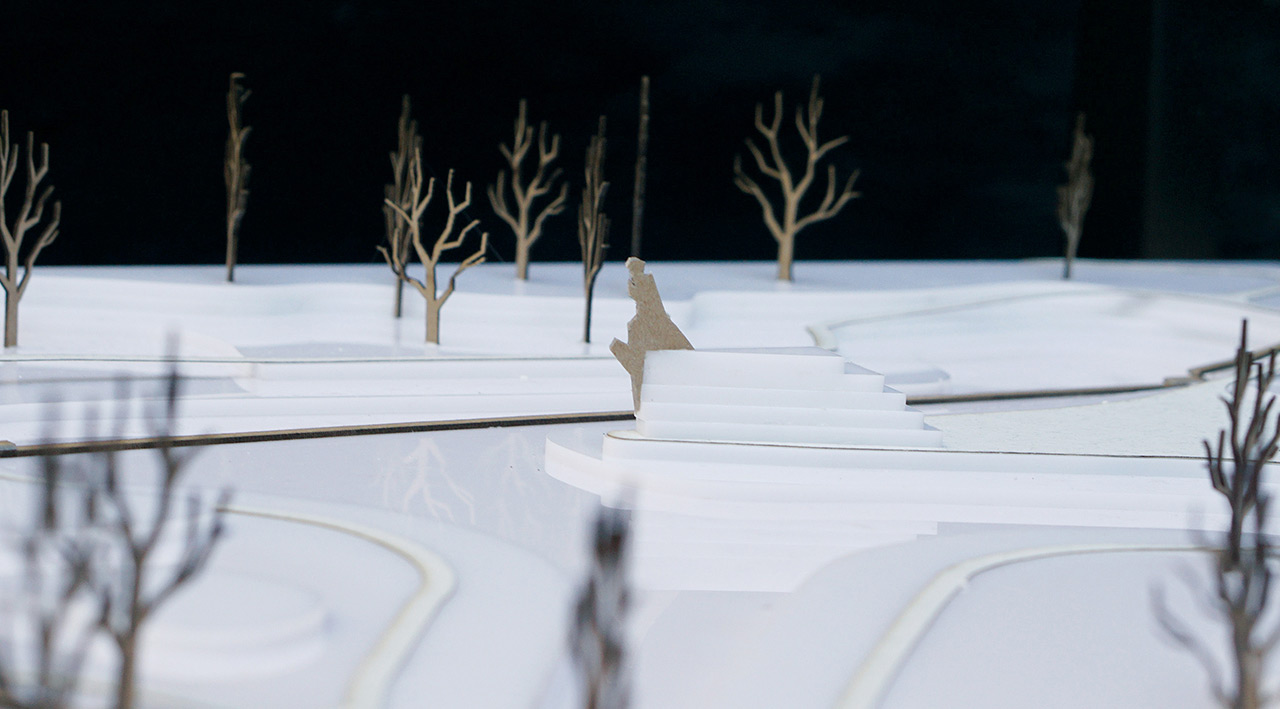
Babyn Yar's landscape bears the marks of historical events. Some of these marks are visible, while others are buried in the ground. The project sets the landscape as a new support for remembrance.
In the past, the installation of some immutable monuments has shown possible manipulation of memory. As a result, the new memorial park requires a more flexible approach, able to show the dynamic nature of the process of remembrance.
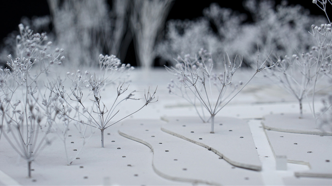
Grids are present on site, similar to the structures of cemeteries. They are also used in archeology to reveal different layers of a space. In this abstract spatial system, fragments refer simultaneously to what is present and what is absent.
This spatial system on which the project is based addresses the problem of preserving coherence between the different memorial forms, and allows the memorial park to evolve in time with new forms of commemoration.
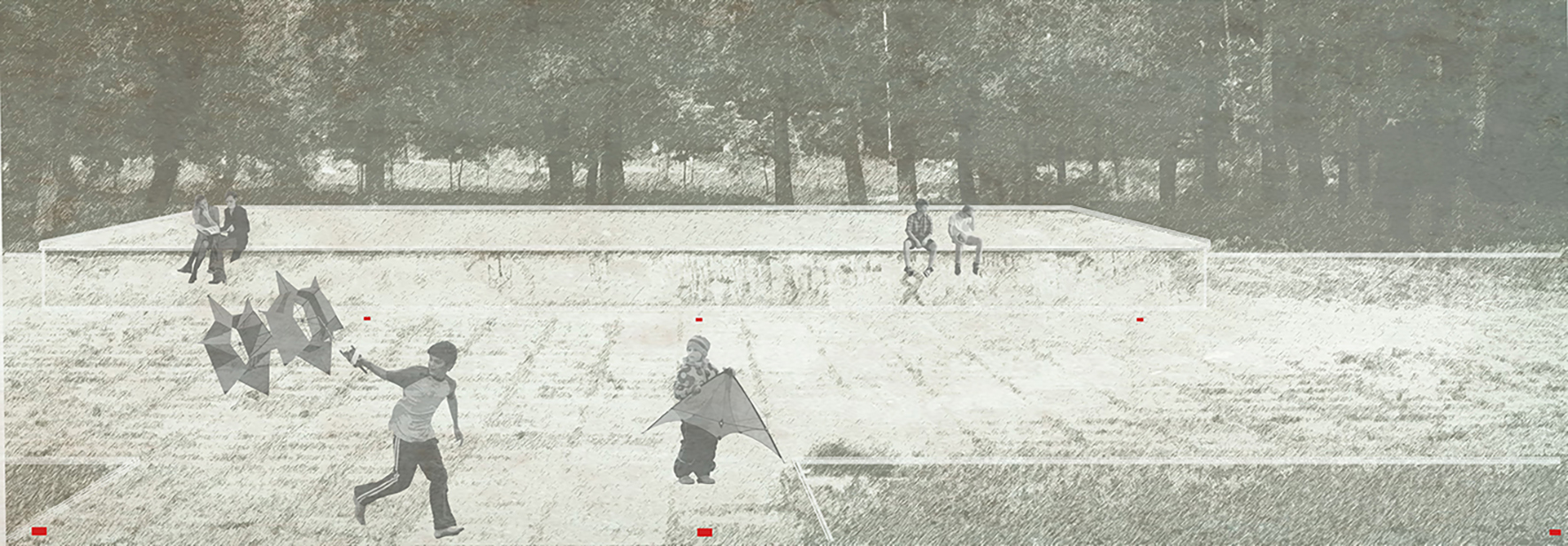
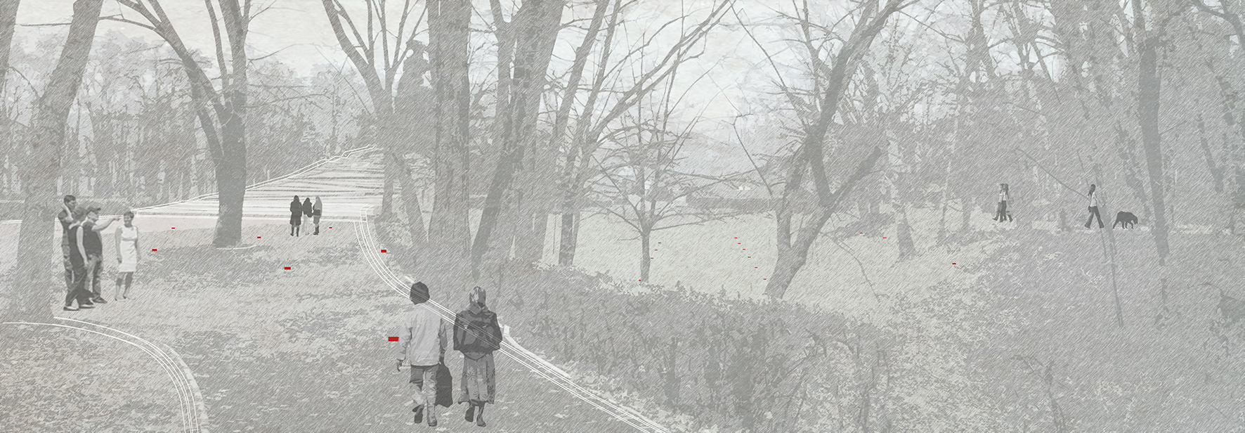
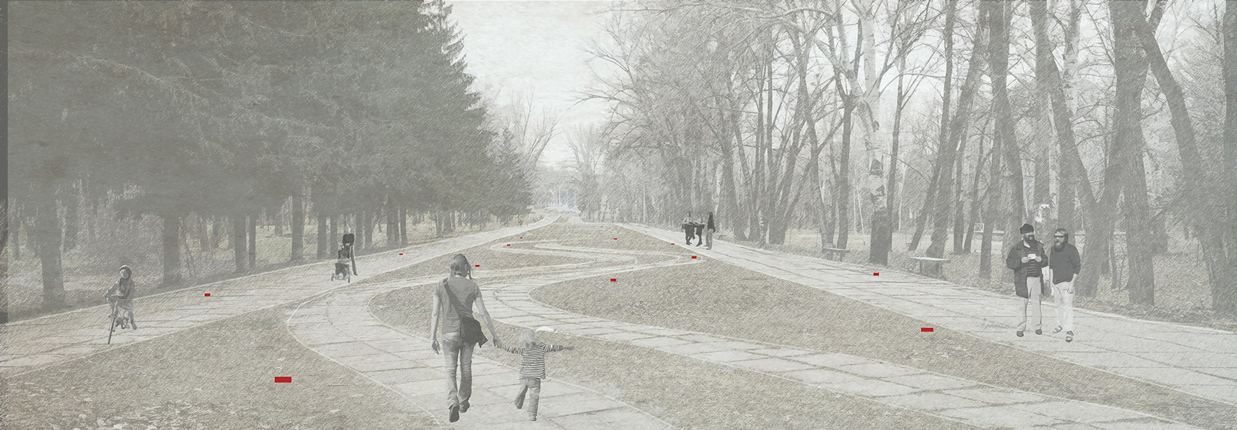
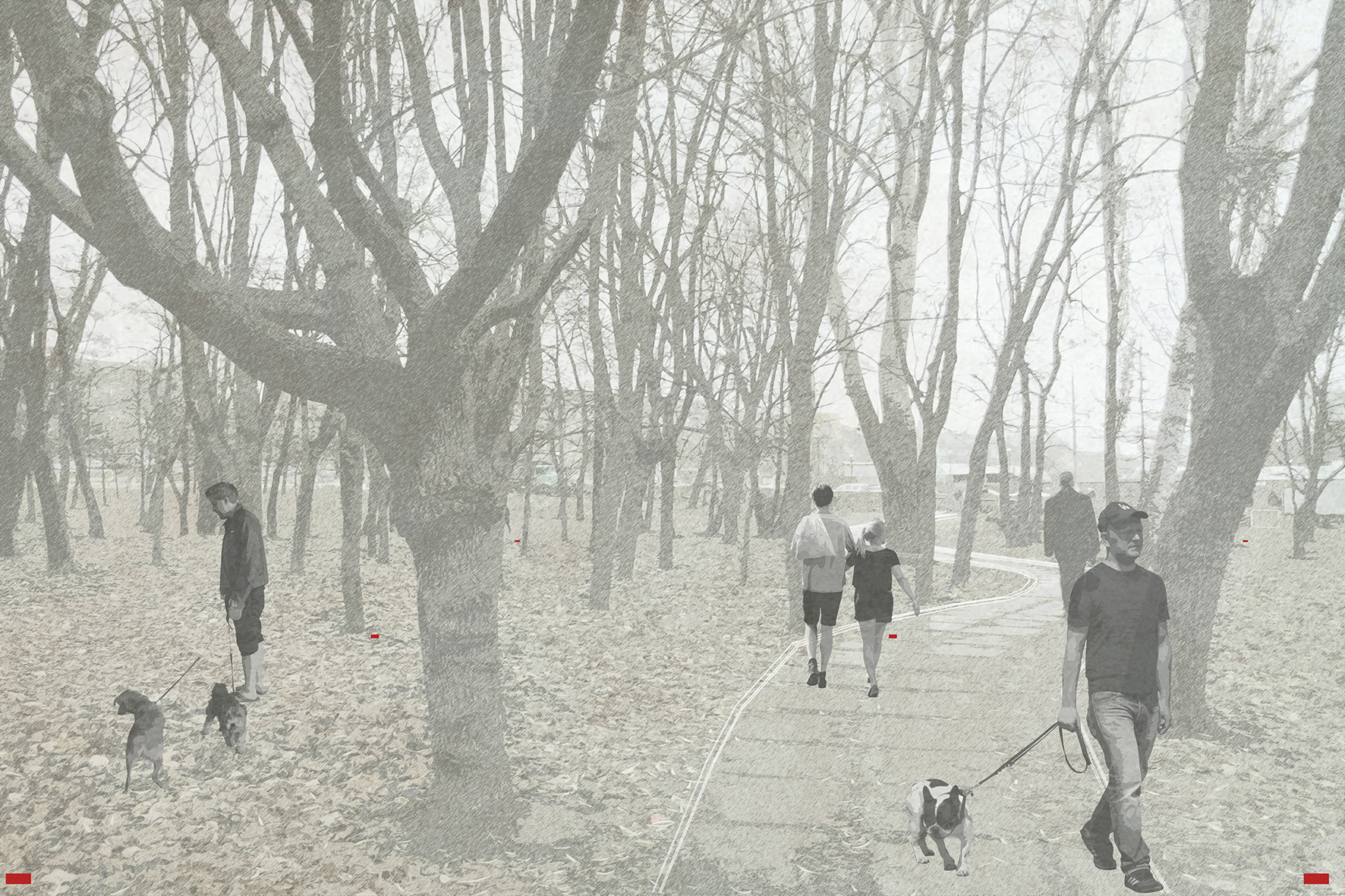
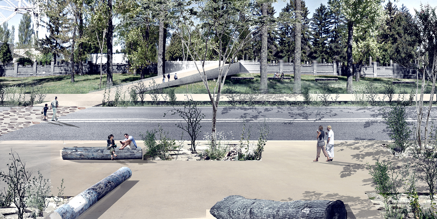
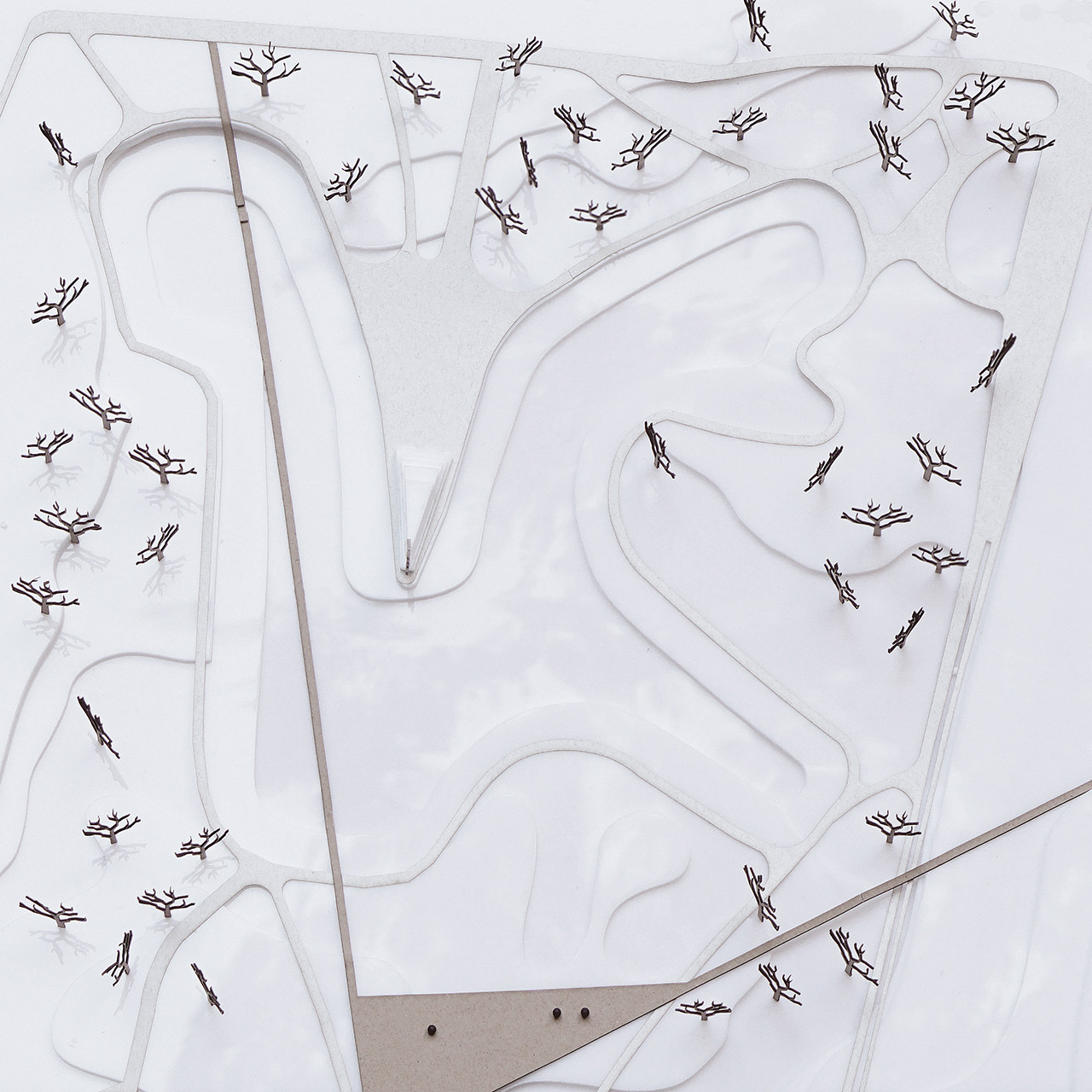
Part of the Project is based on the design of new infrastructures meant to unify the fragmented parts of the memorial, linking the site to the city by two different paths. One connects the different recreational spaces already present on the site, and links the two valleys. The other one is the path of remembrance.
They help to distinguish the memorial zones from the recreational ones. But the junction of them is marked by intersection points, creating a visual connection between the two spaces.
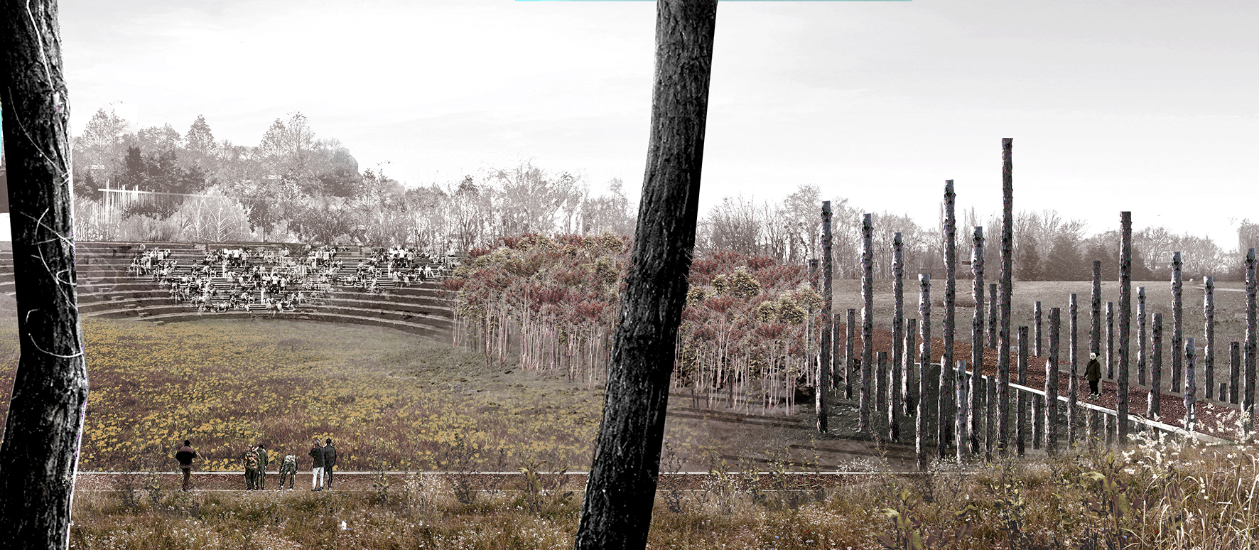
The memory path connects the different monuments located all over the site, marking their unity.
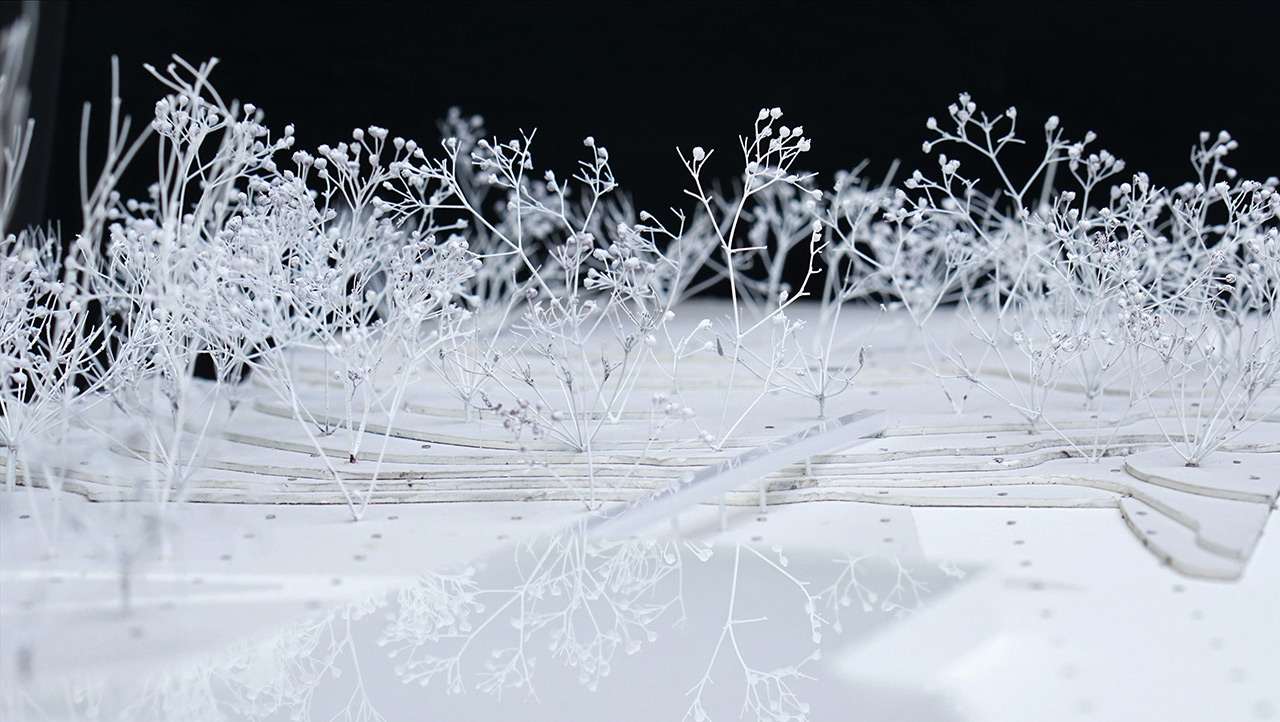
Hornbeam hedges are planted around them, thus creating smaller and intimate spots, unifying the fragmented spaces of remembrance.
The hydrological system of Babyn Yar has disappeared, along with its original topography. By addressing the landslide risk, the superficial drainage ditches create a new water circulation. The hydrological system is buried most of the time, but appears on the surface of the ground at different points, thus contributing to the aesthetics of fragmentation, connecting what is above and what is underground.
The project is composed of a series of independent interventions, making the construction spread out over time. The residue products of some operations are used as resources for subsequent interventions. In this way, the memorial park draws in time on its own resources, the landscape being at the center of a process of resilience and autogeneration.
Autors:
Connatural + Glenn Pouliquen — France and Colombia

Model:
Published: 2016-06-07


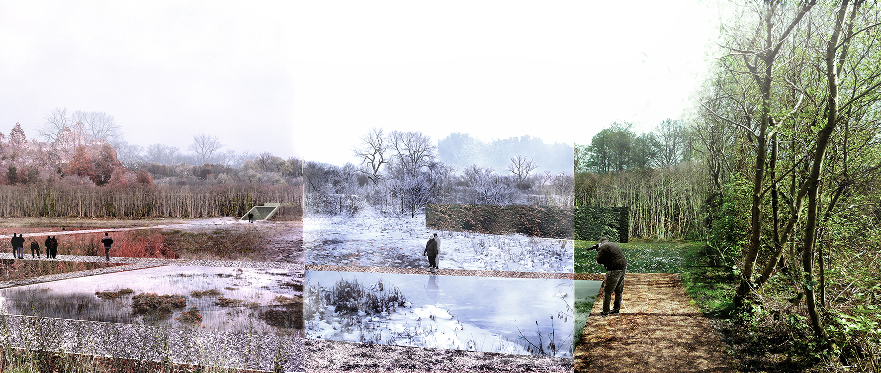
YAHRTZEIT CANDLES
"The soul of man is a candle of the Lord." Proverbs 20:27.
How do we tell the story of Babyn Yar?
Landscapes tell stories; we listen.
This is a detective story. The crimes of the Nazi genocide of Jews and other victims are well known; the crime scene remains purposefully concealed. It cannot be restored. Visitors, like detectives, will discover the clues in the site to imaginatively reconstruct the crime scene. The most significant missing clue is the ravine at Babyn Yar, hidden under multiple layers of desecration and denial. We work through these multiple and contradictory historic layers, the Pentimento (from Italian pentirsi, repentance) to transform the site into a mnemonic device.
Using an overlay of the 1943 Nazi aerial photograph onto the current topographic plan,we discovered the remaining fragments of the original ravine. We recover the boundaries of the mass graves and uncover the ravine with selective clearance of invasive trees and undercover plantings. We stitch the two sides of the crime scene with a walk across Melnikova Street, extending the paving pattern. A new arc along the western edge of the ravine straddles the street, embraces the two sides and links the Russian Monument and the Menorah. To honor the dead, the killing fields are transformed into a field of LED Yahrtzeit candles set in a moss garden.
To complement the clues of the site, apps in different languages will guide with geo-location, images and narratives to explain the clues and events. Poems, music, documentaries and film clips will add to the somber and elegiac mood. The apps will enable visitors to pursue different paths, at their own pace and to retrace their steps to reflect on their experience. Clues will be added over time with new art and discoveries and as funding becomes available.
A structured pilgrimage route will retrace the Via Dolorosa, the Path of the Jews from Lukianivska Square to Babyn Yar.
The landscape becomes a memorial site. It will tell its story in a new way. Memories do not cure, yet they can heal. Through these multiple clues, visitors can experience the site as a space of learning.
Our knowledge can be transformed to empathy and compassion, our sorrow into soulfulness.
Autors:
Miriam Gusevich — Principal — USA
Jay Kabriel
Peter Miles

Model:

Published: 2016-06-07
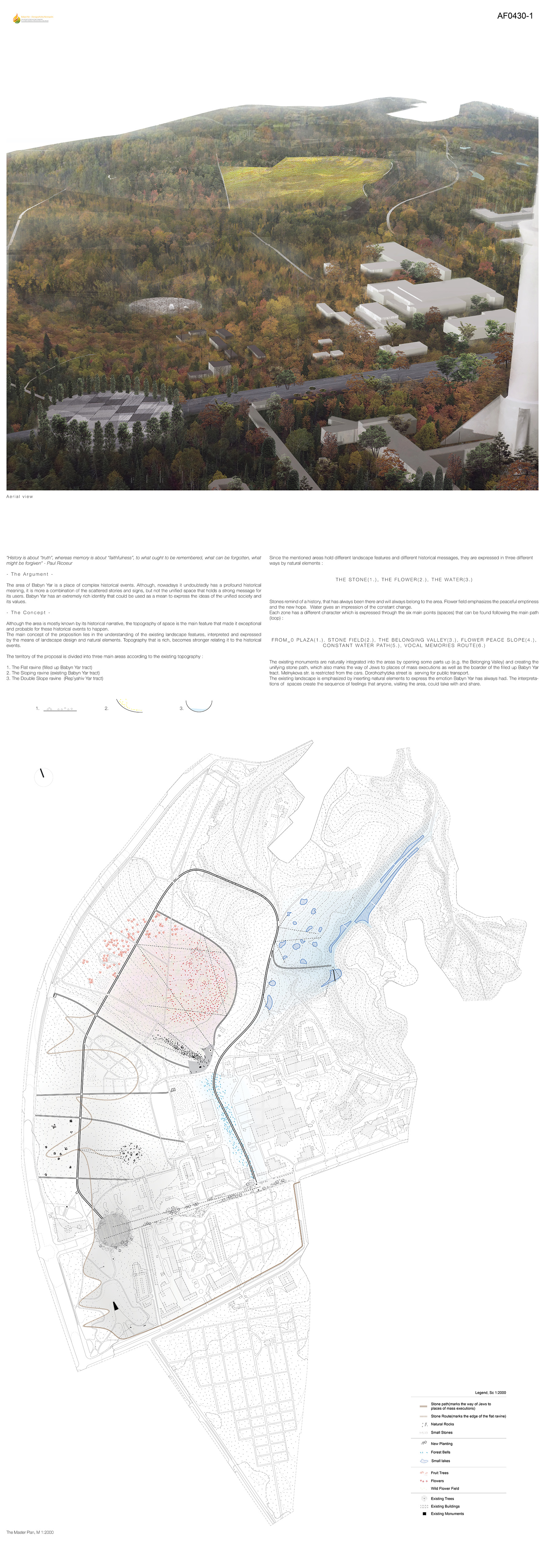

“History is about “truth”, whereas memory is about “faithfulness”, to what ought to be remembered, what can be forgotten, what might be forgiven” - Paul Ricoeur
- T h e A r g u m e n t -
The area of Babyn Yar is a place of complex historical events. Although nowadays it undoubtedly has a profound historical meaning, it is more a combination of scattered stories and signs rather than unified space that holds a strong message for its users. Babyn Yar has an extremely rich identity that could be used as a means to express the ideas of the unified society and its values.
- T h e C o n c e p t -
Although the area is mostly known by its historical narrative, the topography of space is the main feature that made it exceptional and probable for these historical events to happen.
The main concept of the proposition lies in the understanding of the existing landscape features, interpreted and expressed by the means of landscape design and natural elements. Topography that is rich, becomes stronger relating it to the historical events.
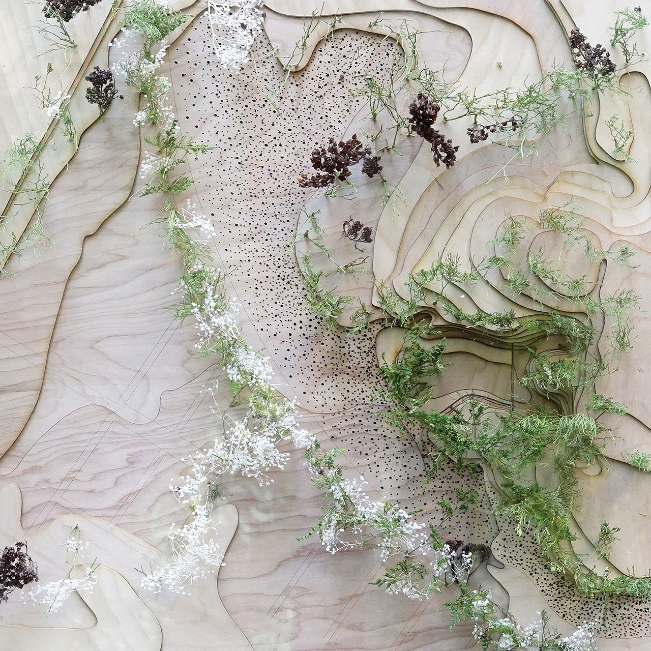
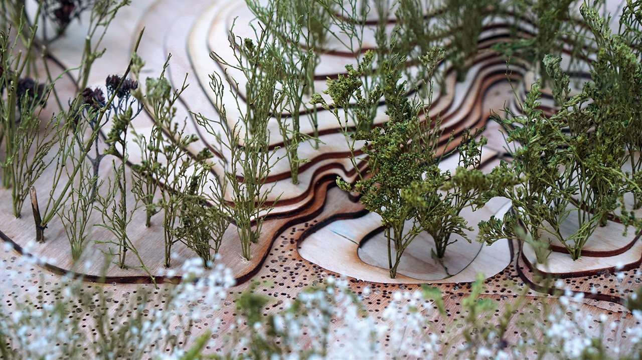
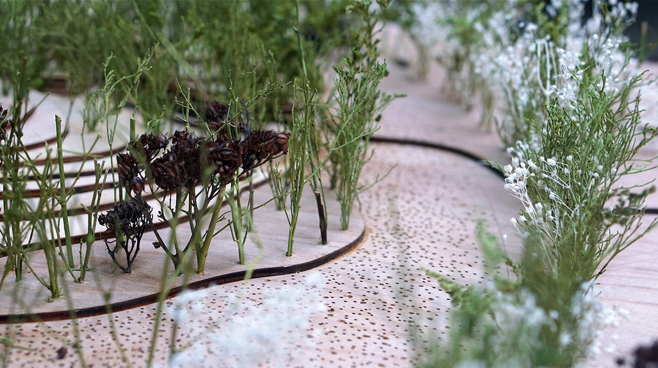
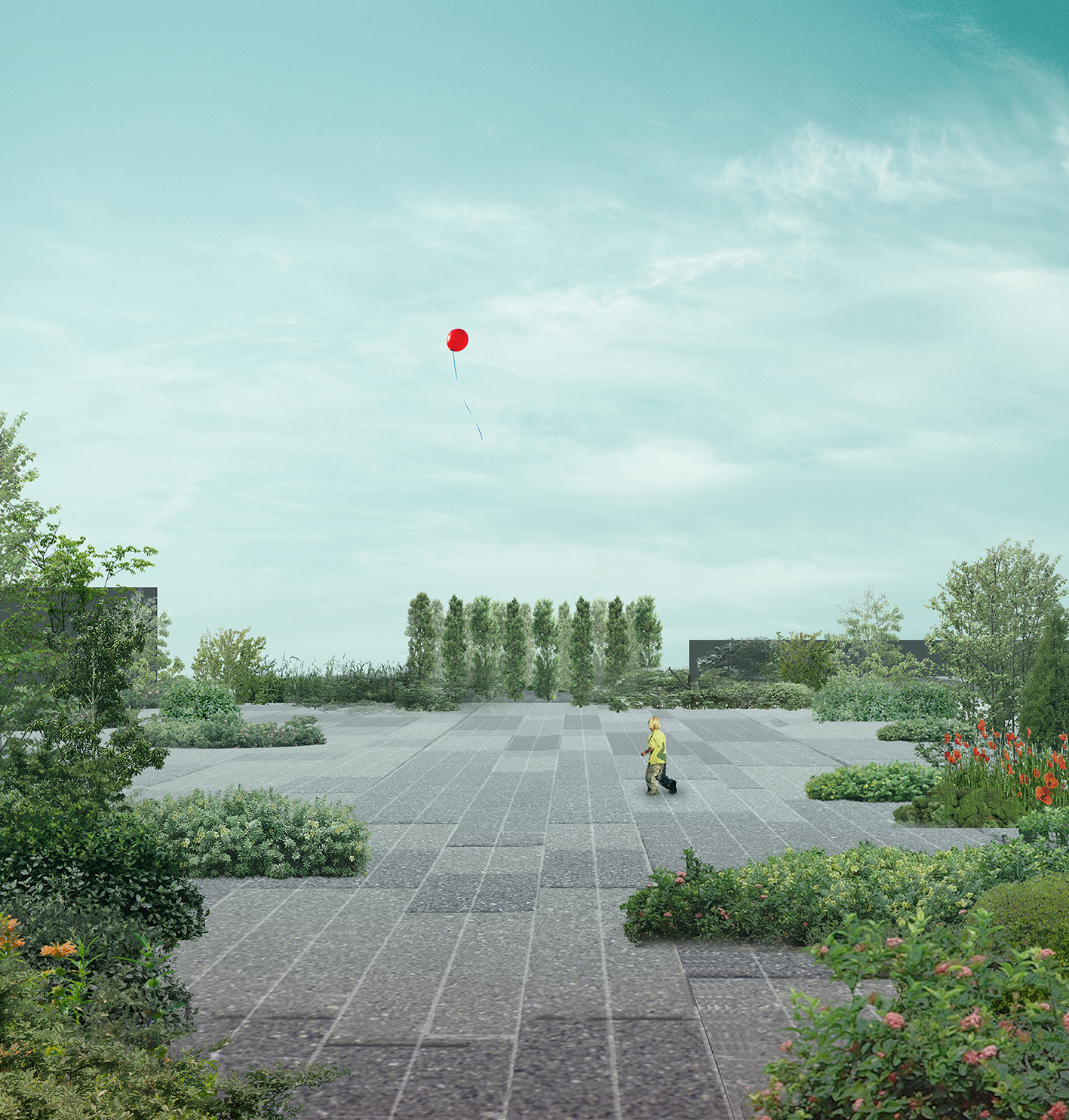
THE STONE, THE FLOWER, THE WATER
Stones remind of a history, that has always been there and will always belong to the area. Flower field emphasizes the peaceful emptiness and the new hope. Water gives an impression of the constant change.
PLAZA, STONE FIELD, THE BELONGING VALLEY, FLOWER PEACE SLOPE, CONSTANT WATER PATH, VOCAL MEMORIES ROUTE
The existing monuments are naturally integrated into the areas by opening some parts up (e.g. the Belonging Valley) and creating the unifying stone path, which also marks the way of Jews to places of mass executions as well as the border of the filled up Babyn Yar tract. Car traffic on Melnykova Str. becomes restricted. Dorohozhytzka Str. is serving for public transport.
The existing landscape is emphasized by inserting natural elements to express the emotion Babyn Yar has always had. The interpretations of spaces create the sequence of feelings that anyone, visiting the area, could take with them and share.
Autors:
Ieva Baranauskaite — Architect — Denmark
Yang Wang — Architect — Denmark
Employees, students, freelance collaborators: YuJiao Wang

Model:

Published: 2016-06-07
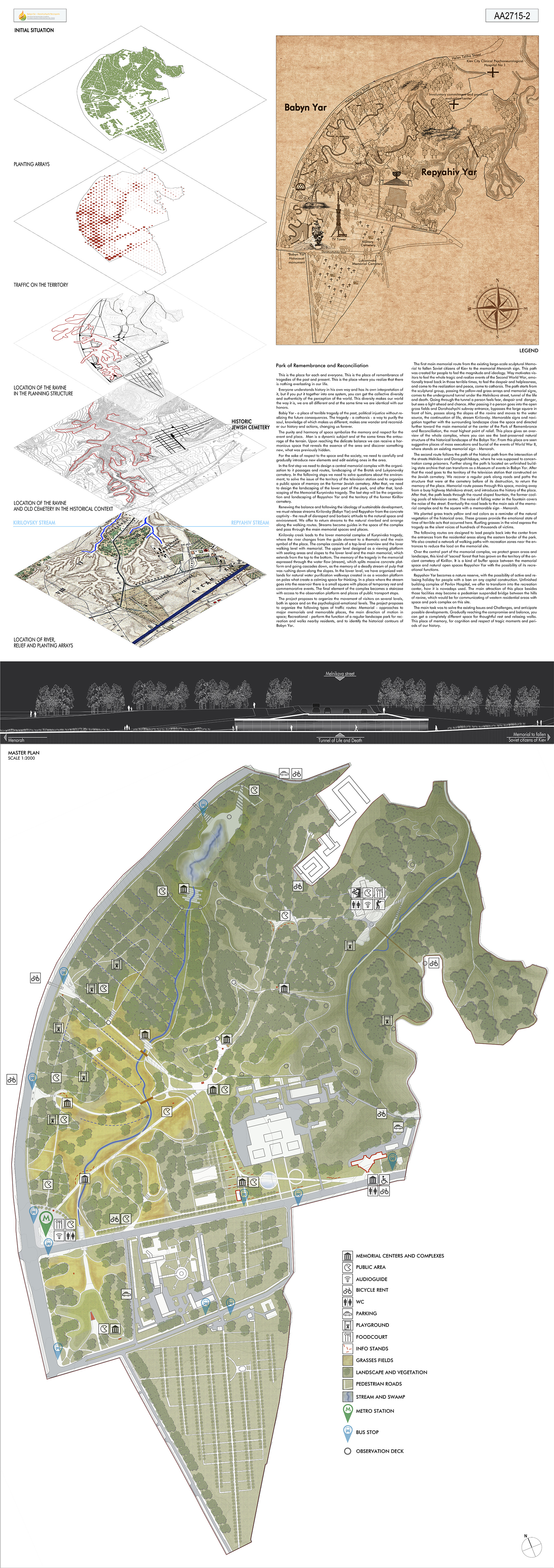
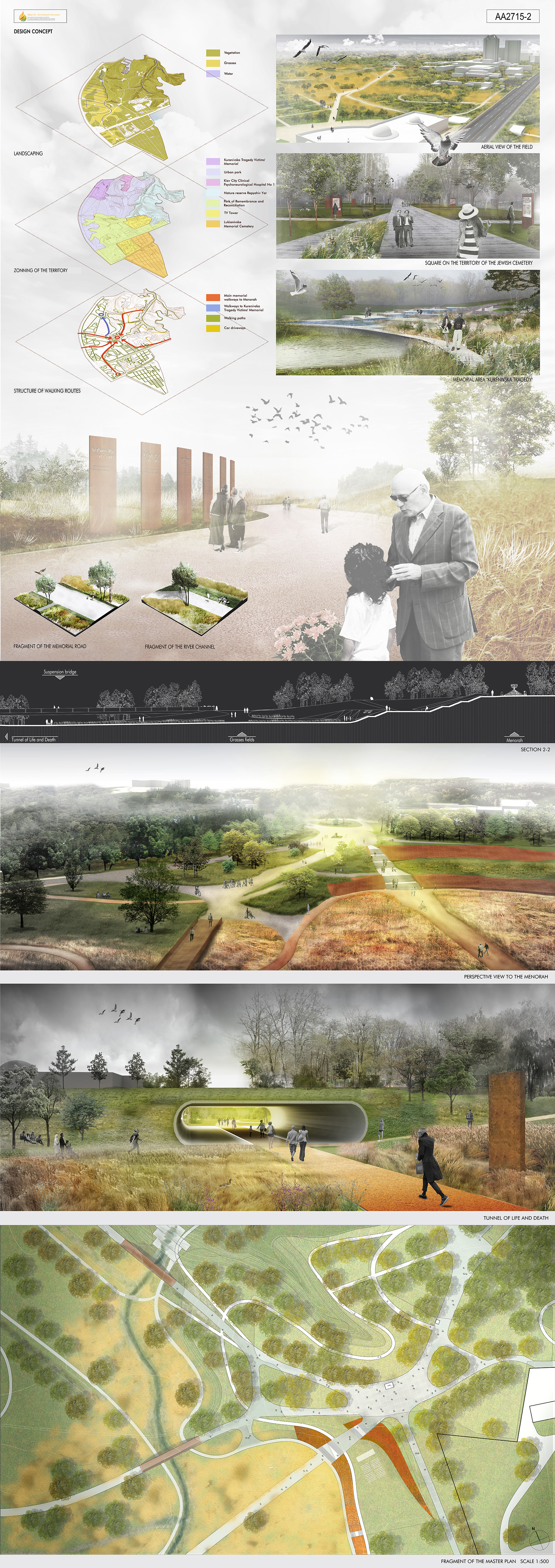
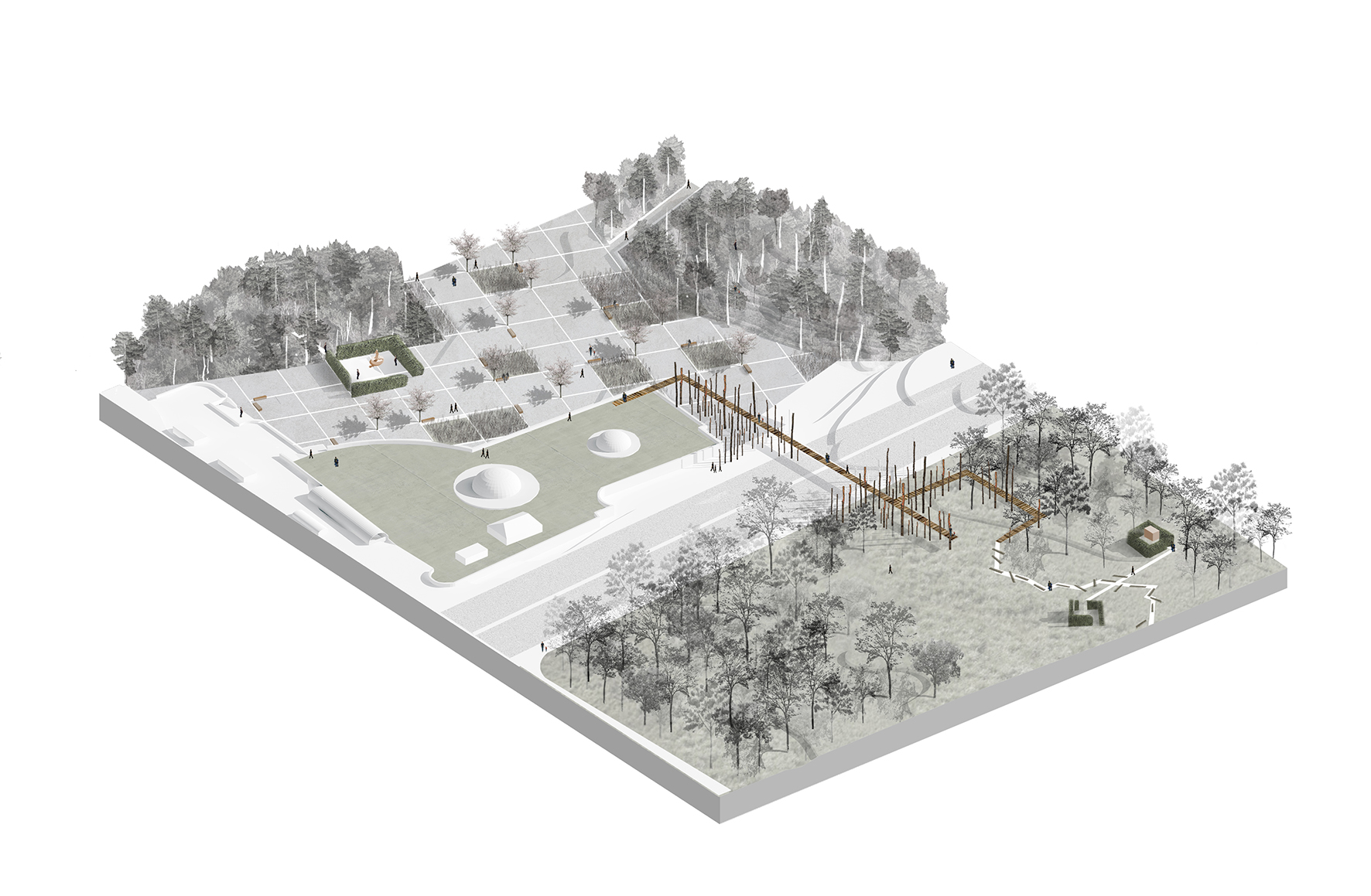
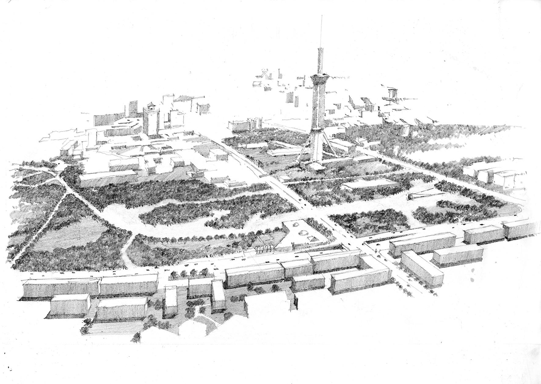
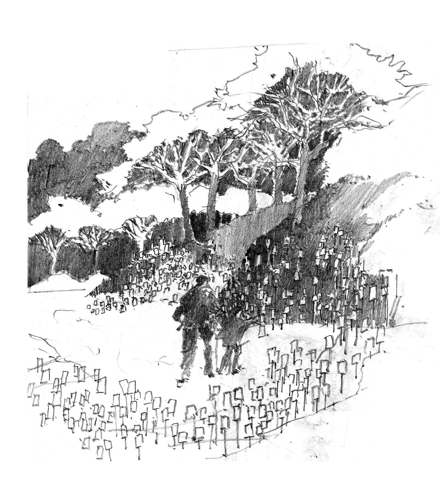
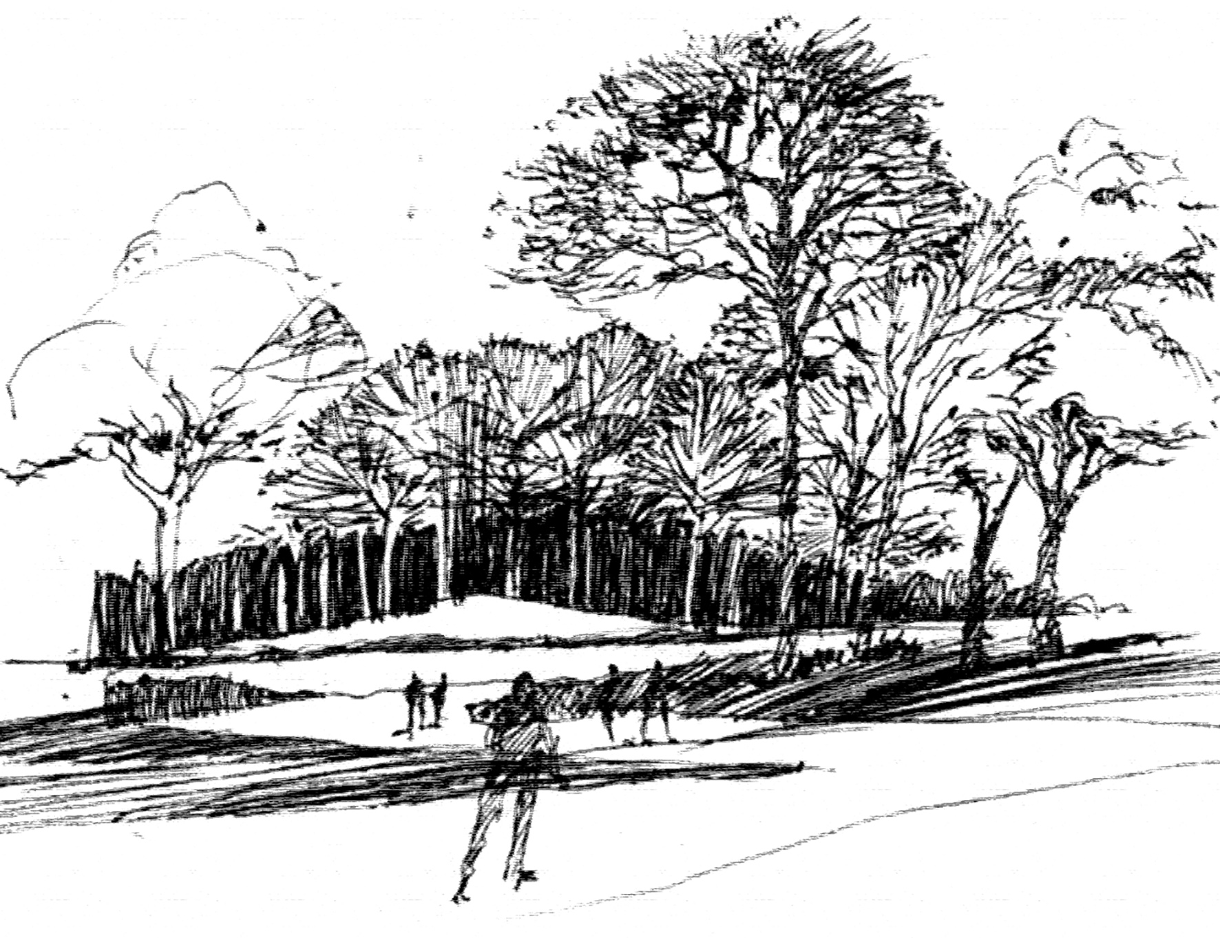
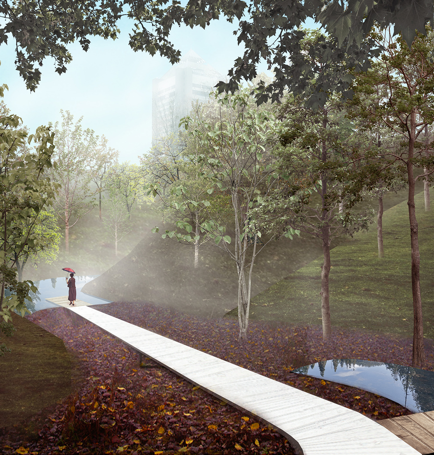
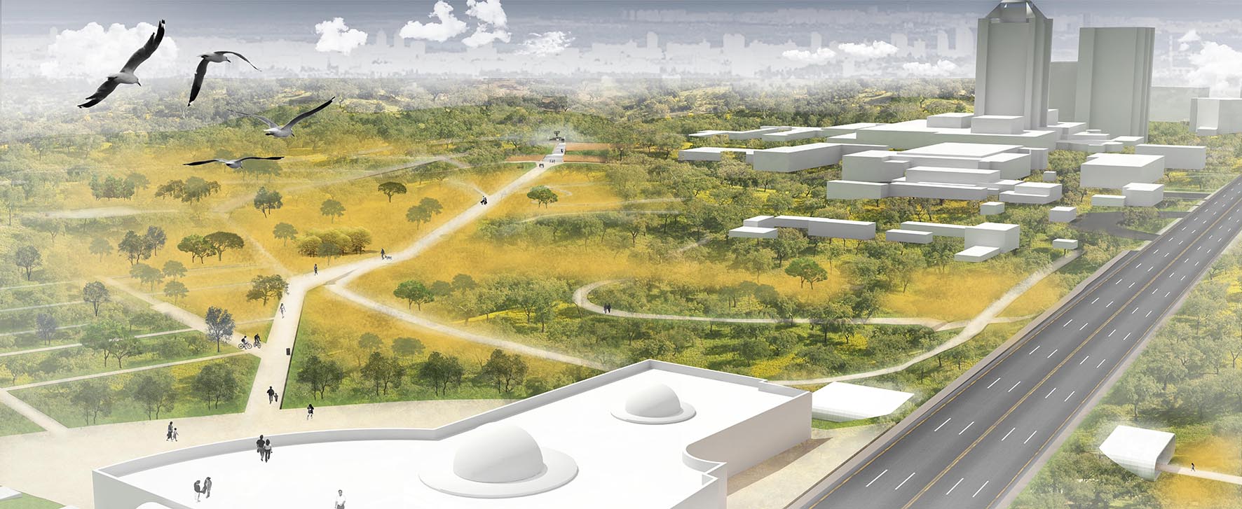
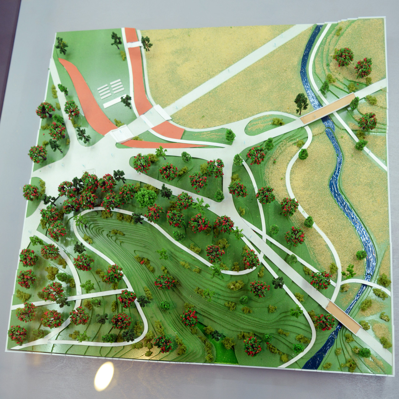
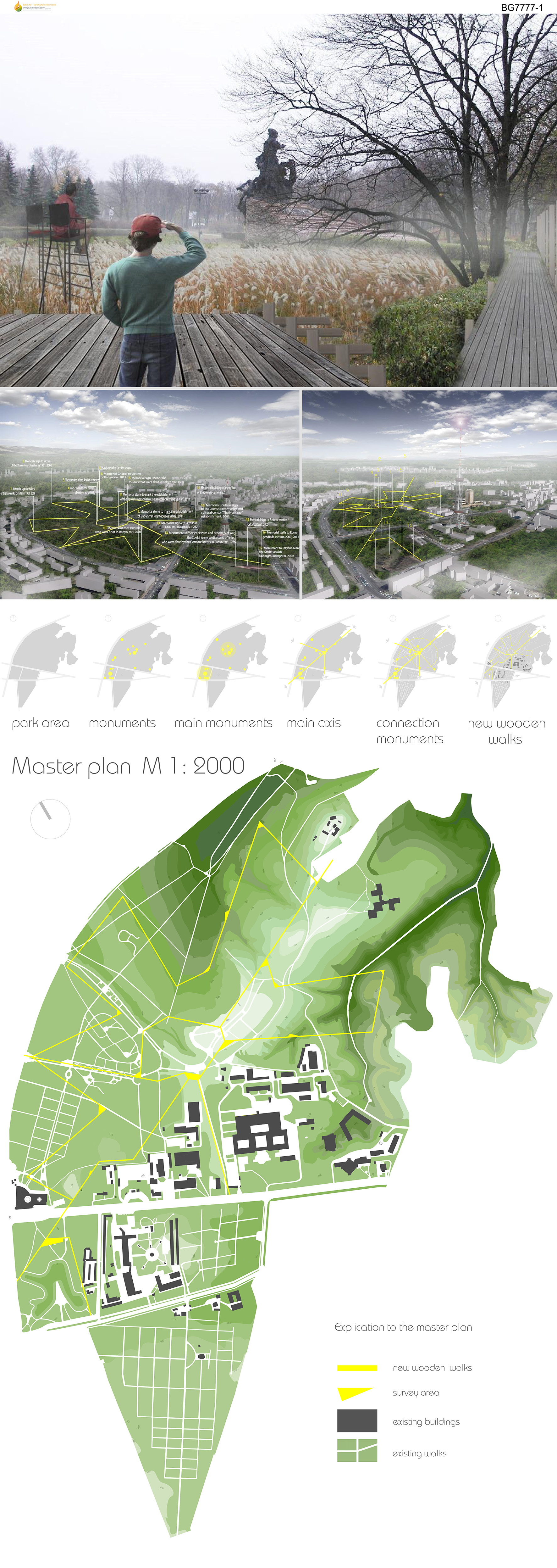
Park of Remembrance and Reconciliation
This is the place for everyone. This is the place of remembrance of tragedies of the past and present. This is the place where you realize that there is nothing everlasting in our life.
Everyone understands history in one's own way and has one's own interpretation of it, but if you put it together into one system, you can get the collective diversity and authenticity of the perception of the world. This diversity makes our world the way it is, we are all different and at the same time we are identical in our characteristics.
Babiy Yar - a place of terrible tragedy of the past, a political injustice with no regard for the consequences. The tragedy - a catharsis - a way to purify the soul; the knowledge of it makes us different, makes one wonder and reconsider our history and actions, changing us forever.
The purity and harmony of a space symbolize the memory and respect for the event and the location. Human beings are a dynamic subject and at the same times the entourage of the terrain. By reaching the delicate balance we can produce a harmonious space that reveals the essence of the area and brings forth something new, something that was previously hidden.
For the sake of respect to the space and the society, we need to carefully and gradually introduce new elements and edit existing ones in the area.
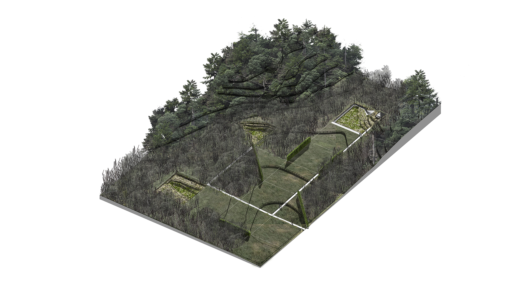
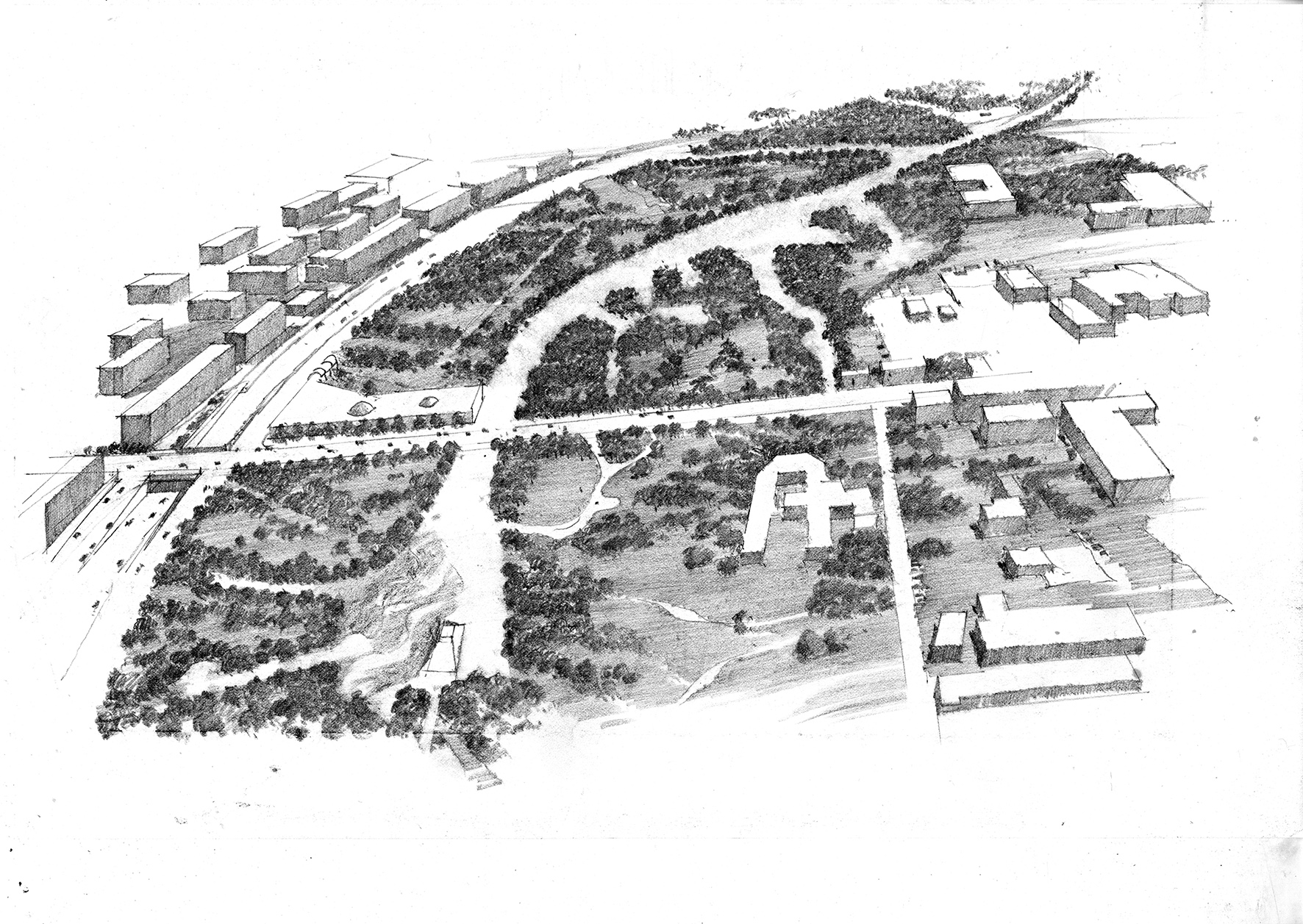
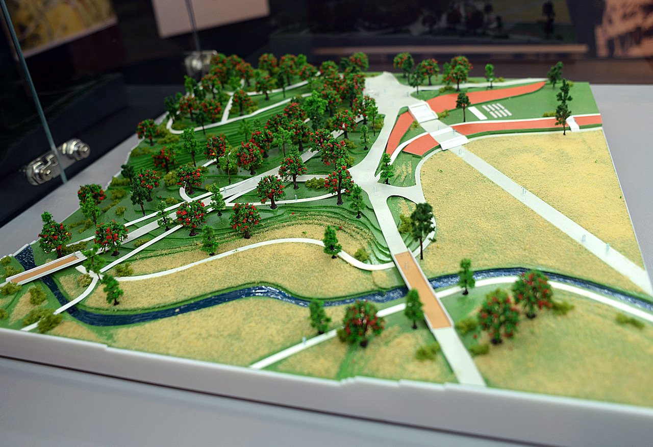
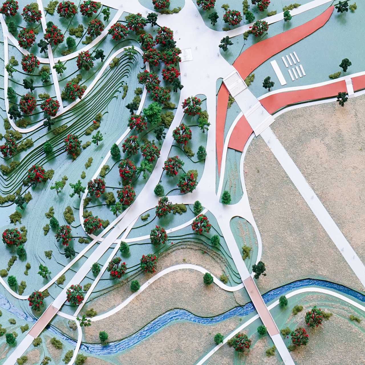
As our first step, we need to design a central memorial complex, providing for passages and routes leading to it and ensuring adequate landscaping of the Bratske and Lukyanovske cemeteries. The subsequent steps have to address the issues of the environment, dealing with the matter of the territory of the TV broadcast tower and establishing the public memorial space in the former Jewish cemetery. After that, we need to design the landscaping of the lower part of the park; the next step would be landscaping for a memorial of the Kurenivska tragedy. The last step will be the organization and landscaping of Repyakhiv Yar and the territory of the former Kyrylivske cemetery.
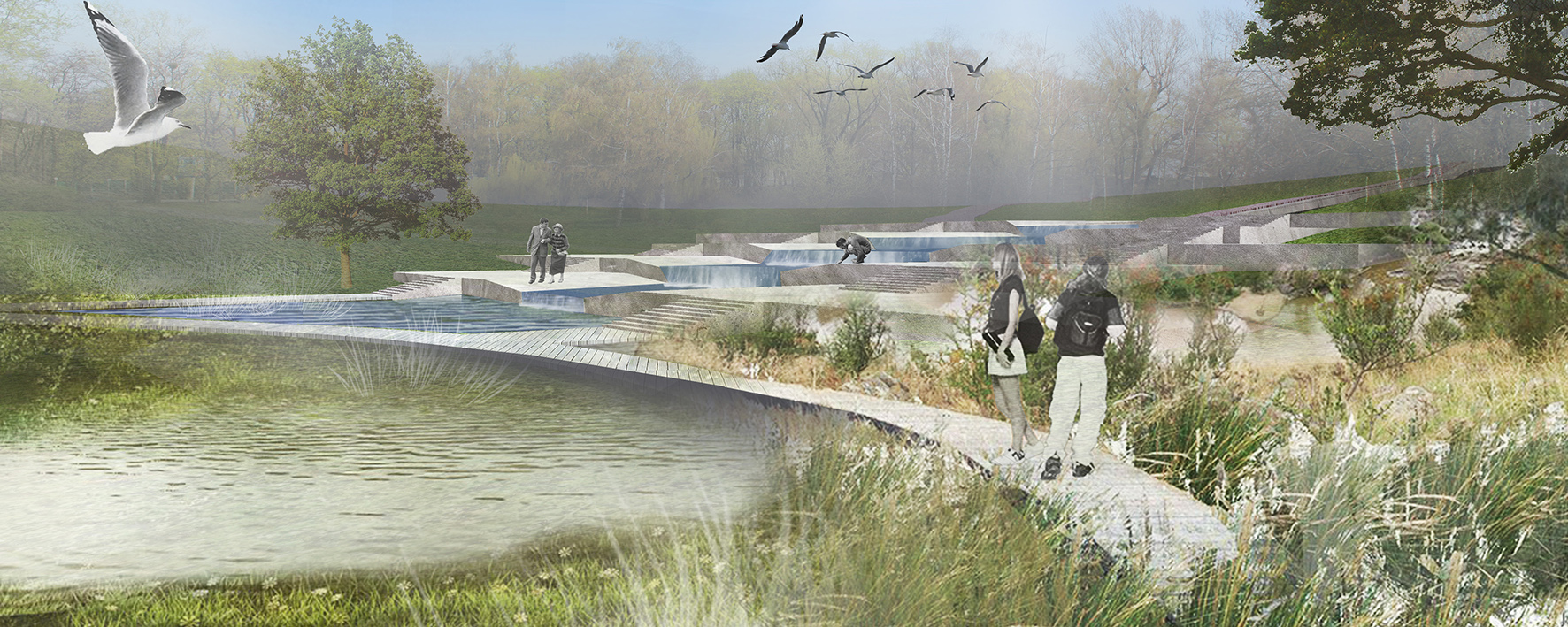
As we restore the balance and follow the ideology of sustainable development, we must free Kyrylivsky creek (Babyn Yar) and Repyakhiv creek from the concrete captivity - the result of disrespect and barbaric attitude to the natural space and environment. We suggest returning the creeks to the natural riverbed and set up walkways alongside them. The creeks become guides in the space of the complex and pass through the main memorial spaces and places.
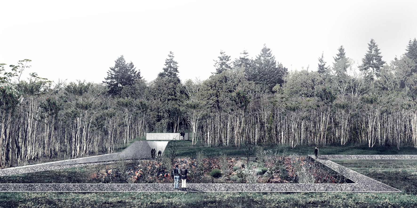
Kyrylivsky creek leads to the lower memorial complex of Kurenivska tragedy, where the river changes from the guiding element to a thematic one and the main symbol of the place. The complex consists of a top-level overview and the lower walking level with a memorial installation. The upper level is designed as a viewing platform with resting areas and slopes to the lower level and the main memorial, which extends from the top to the bottom. The memory of the tragedy in the memorial is expressed through a waterflow (stream), which splits a massive concrete platform and cascades further on down, in memory of the deadly stream of pulp that was rushing down these slopes. On the lower level, we have set up a body of water allowing for cleansing the walkways with natural water; these are designed as wooden platforms on poles that create a calming space for reflection. In the place where the stream empties into the reservoir there is a small plaza with seats arranged as a resting area or as a venue for commemorative events. The final element of the complex is a staircase providing access to the observation platform and to public transport stops.
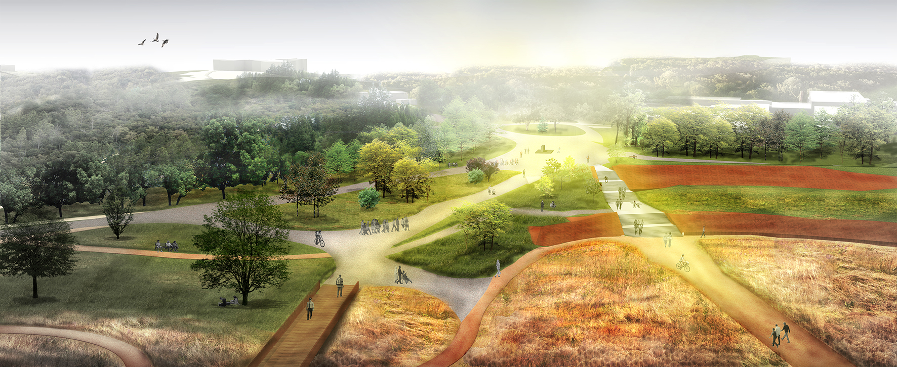
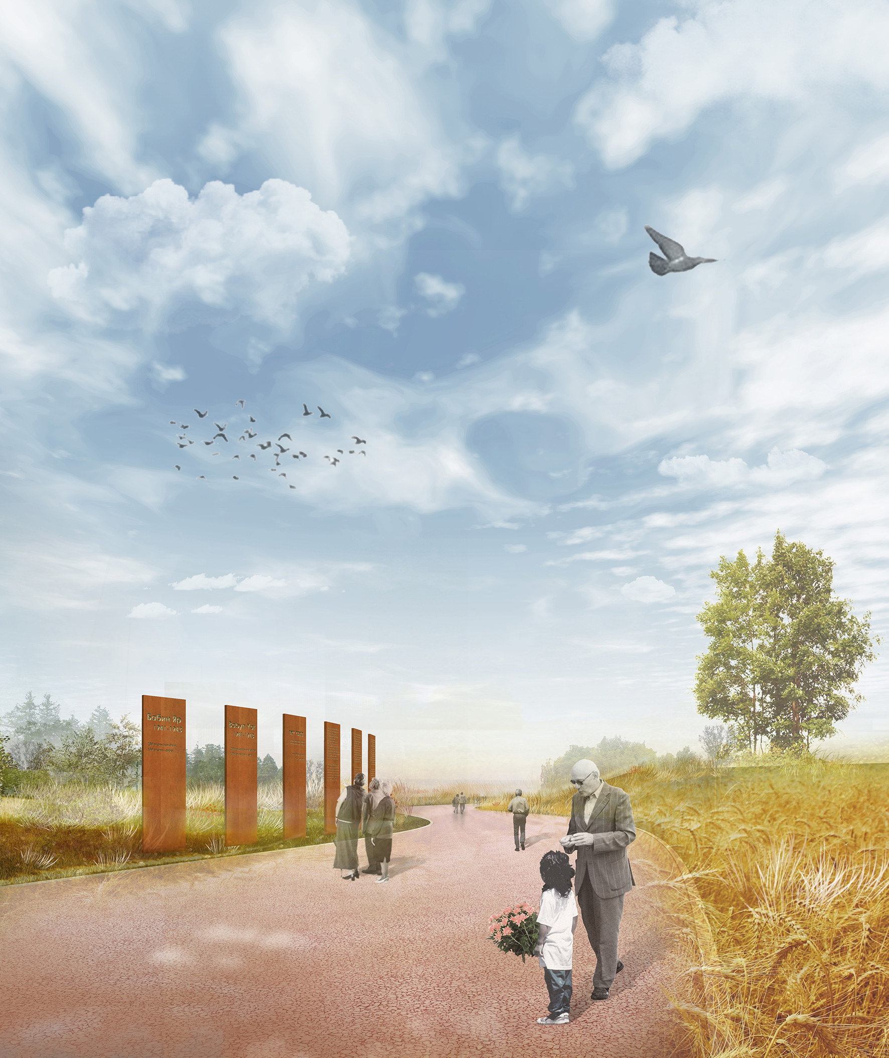
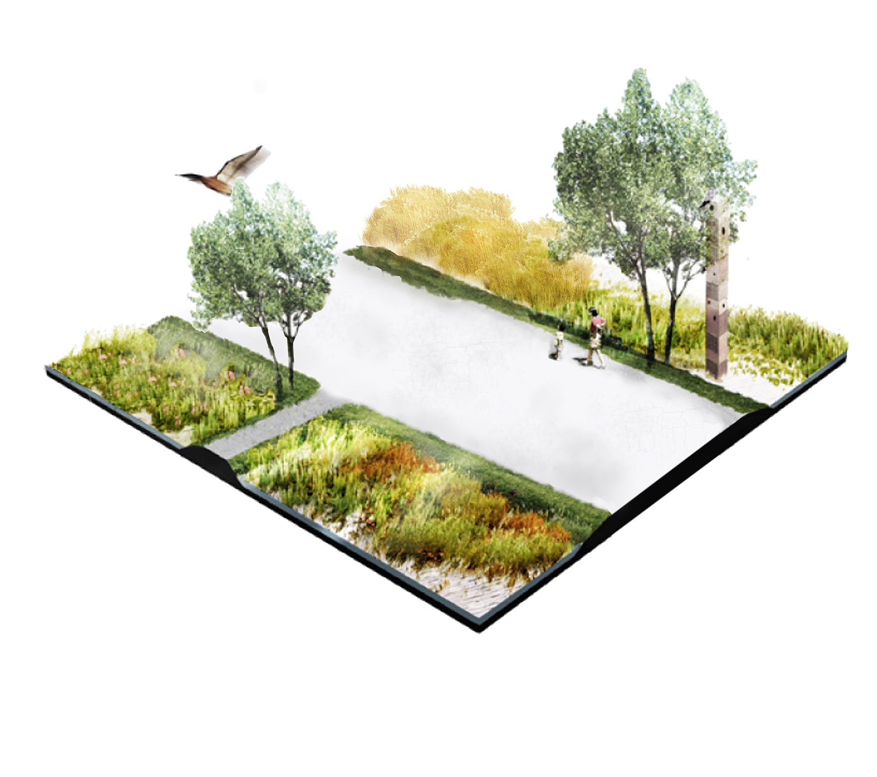
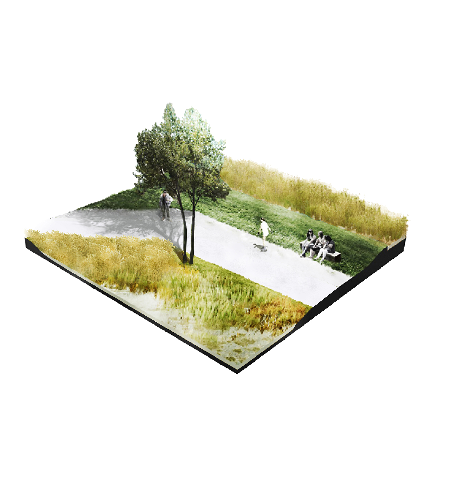
The project proposes to organize the movement of visitors on several levels, both in the physical space and on the psychological and emotional plane. The project proposes the following types of traffic routes: the memorial route—access points to major memorials and memorable places, the main direction of movement in the physical space; the recreational element—functioning as a regular landscape park for recreation and walks for nearby residents, and also marking the historical outlines of Babyn Yar.
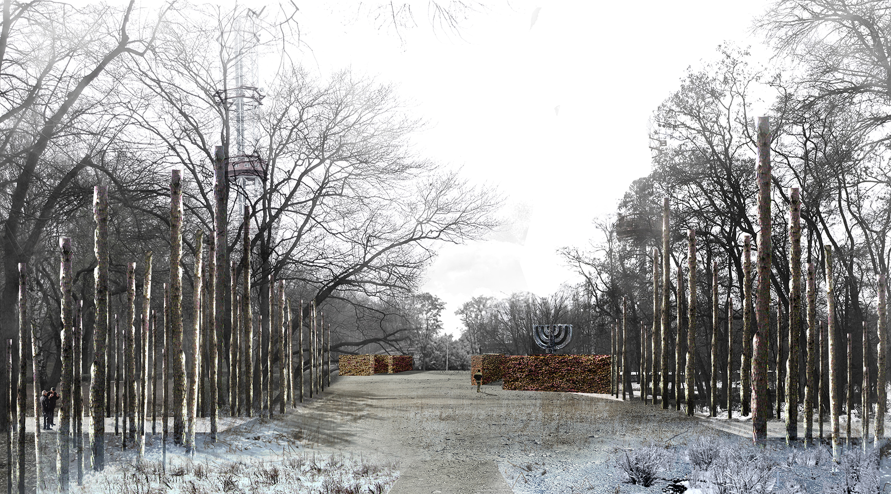
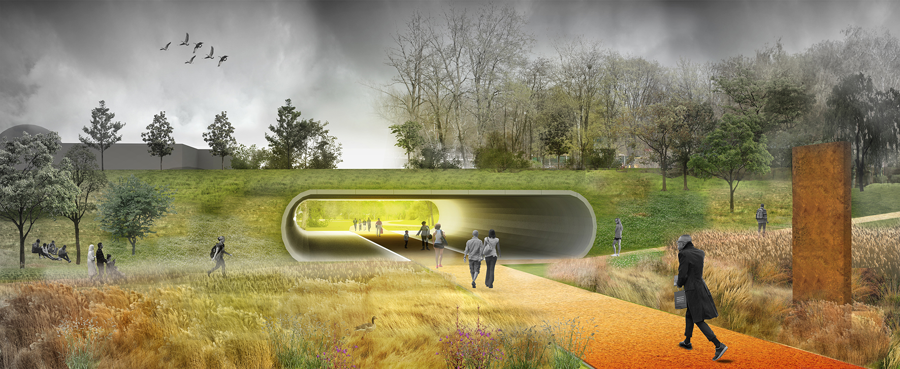
The first main memorial route leads from the existing large monument to fallen Soviet citizens of Kiev to “the Menorah” memorial marker. This path was created for people to feel the scale and the ideology. The route motivates visitors to feel the full extent of the tragic nature and comprehend the events of the Second World War, to emotionally travel back to those terrible times, to feel the despair and helplessness, and come to realization and peace, come to catharsis. The path starts from the monument and runs through arrays of yellow-red grass and memorial signs, comes to the underground tunnel under Melnikova Street, the tunnel of life and death. As one passes through the tunnel one feels fear, despair and danger, but also sees the light ahead and new chances. After passing through it one exits onto an open grass field and to the entrance to the Dorohozhychi subway station, crosses a large square in front of it, passes along the slopes of the ravine and goes on to the water source, the continuation of life, the Kyrylivsky creek. Memorial markers and navigation signage, together with the surrounding landscape, enclose the physical space and direct visitors further toward the main memorial at the center of the Park of Remembrance and Reconciliation, the highest point of the terrain. This place gives an overview of the whole complex, where one can see the best-preserved natural structure of the historical landscape of the Babyn Yar. Visible from this spot are the probable locations of mass shootings and mass burials during World War II; the Menorah, an existing memorial, is also located here.
The second route follows a historical path from the intersection of the Melnikova Str. and Dorohozhytska Str., where a concentration camp was located. Further along the path is the unfinished building of the state archive that can be transformed into a museum of events that happened at Babyn Yar. After that, the road leads to the territory of the television broadcast station that was built in the Jewish cemetery. We are restoring a regular park along the roads and paths of the structure that used to be the cemetery before its destruction, in order to revive the memory of the place. The memorial route passes through this space, moving away from the busy highway of Melnikova Str., providing an introduction to the history of this place. After that, the path leads past the round fountain on the slope, the former cooling pools of the television center. The noise of falling water in the fountain drowns out the noise of the street. Eventually the road leads to the main axis of the memorial complex and to the square with a memorial marker—the Menorah.
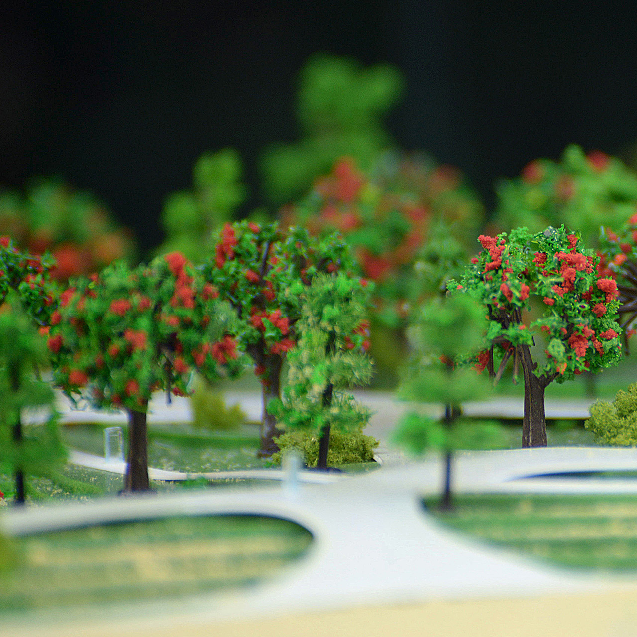
We planted tracts of yellow and red grass that are supposed to act as a reminder of the natural vegetation of this historical area. These grass types evoke the emotional state from the time of terrible events that occurred here. The sound of grass rustling in the wind expresses the tragedy as if it were the silent voices of hundreds of thousands of victims.
Other routes are designed to lead people back to the center, starting from the access points from the residential areas along the eastern border of the park. We also created a network of walking paths with recreation zones near the access points to reduce the load on the memorial site.
Over the central part of the memorial complex, we leave the green areas and the landscape protected—this is a kind of a "sacred" forest that has grown on the territory of the old Kyrylivske cemetery. It is a type of a buffer zone between the memorial space and the open natural spaces of the Repyakhiv Yar with its possible recreational functions.
Repyakhiv Yar becomes a nature reserve, with the possibility of active and relaxing recreation for people and a ban on any construction of permanent buildings. We propose to transform the unfinished building complex of the Pavlov Hospital into a recreation center—as it is actually used now. The main attraction of this place beside those facilities could become the unfinished pedestrian bridge between the hills of ravine, which would connect western residential areas with this site and its park facilities.
The main task was to tackle the existing issues and challenges, and to anticipate possible future development. As we aim for gradual achievement of compromise and balance, we can get a completely different space for reflection and relaxing walks. This place is to be the place of memory, learning, and respect for the tragic moments and periods of our history.
Autors:
Valentyn Uvarov — Kyiv, Ukraine
Dmytro Kazakov — Kyiv, Ukraine
Ievgenii Kolmakov — Kyiv, Ukraine
Iryna Chaus — Kyiv, Ukraine
Employees, students, freelance collaborators: Olga Virchenko
Model:


Published: 2016-06-07

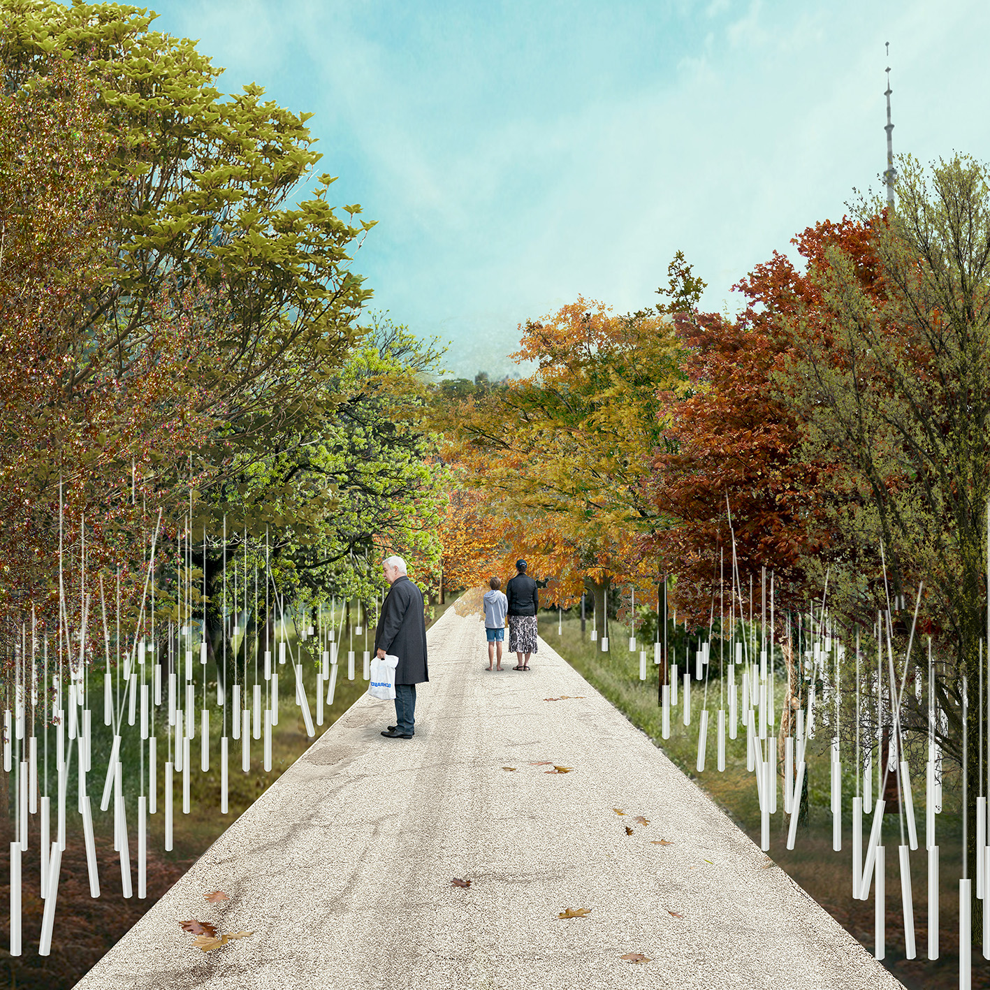
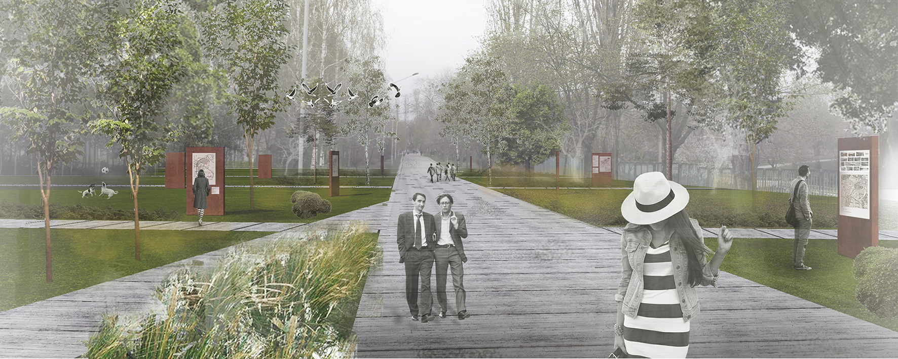
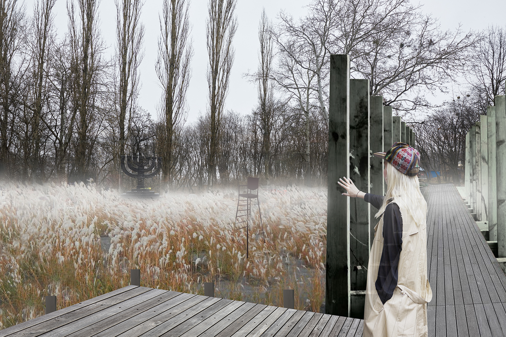
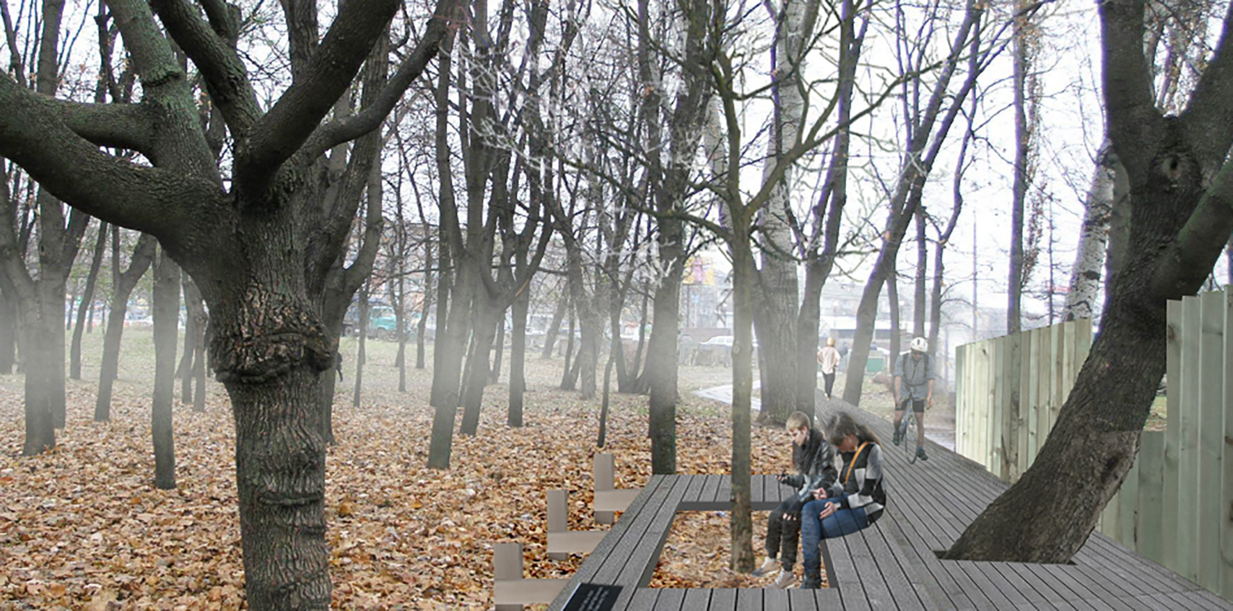
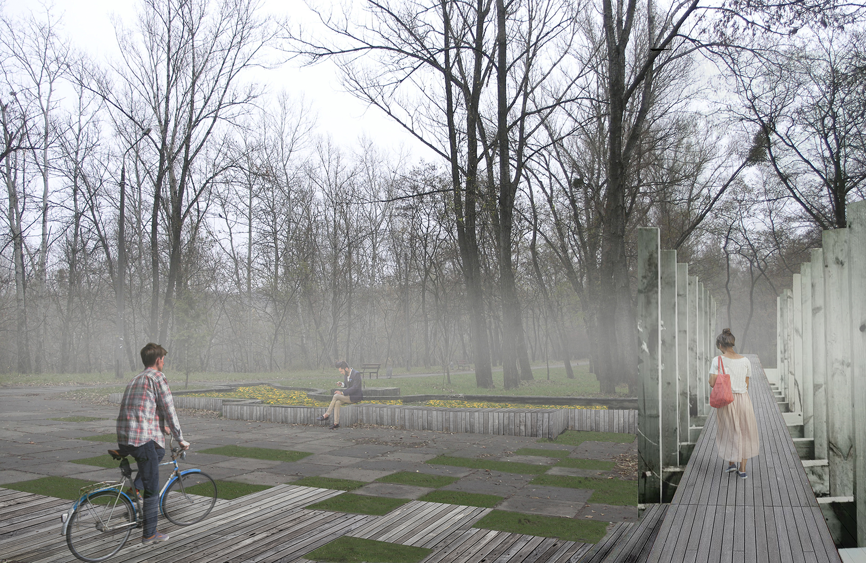
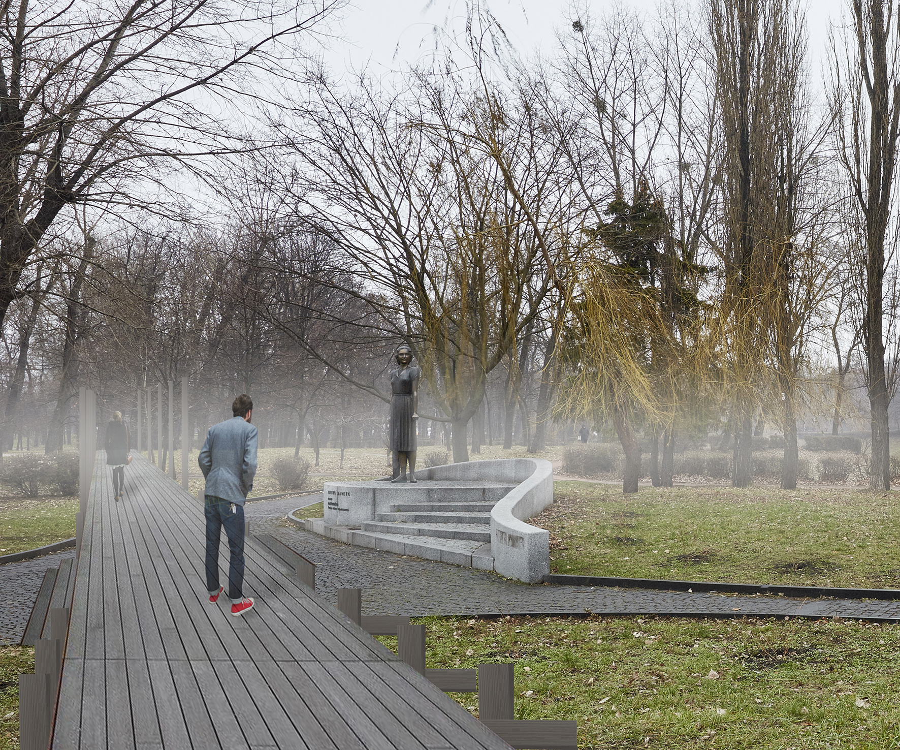
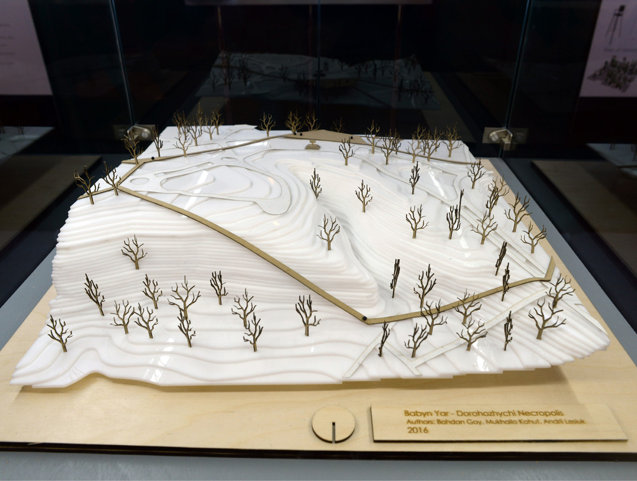
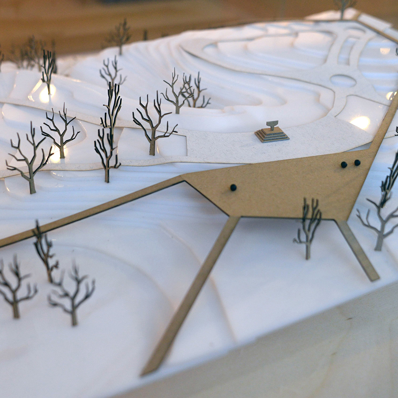
The idea of the project is to provide the means of easy movement around the park and to link all of the monuments placed on the territory spatially and conceptually. It is achieved by using wooden walkways which form the external and internal ring for moving about. In-between the memorial monuments, ornamental grass (feathergrass or similar) is sprouting white spikes that have a symbolic meaning of sifted human ash. High-legged "Chairs of memory" are not only design elements of environment - they are also places for contemplation and reflection about the fluidity of life. The Walkway of Memory forms the main axis. It is flanked on both sides with structures comprising wooden girders and flooring. The main entrances to the park are oriented from the Oleny Telihy Street and Melnikova Street. The subway station located nearby provides a constant change of the flow of people in the park and its openness to all visitors.
Autors:
Bohdan Goy — Chief Architect — Lviv, Ukraine
Employees, students, freelance collaborators: Mykhailo Kohut, Yulia Minko, Andrij Lesiuk


Model:

Published: 2016-06-07
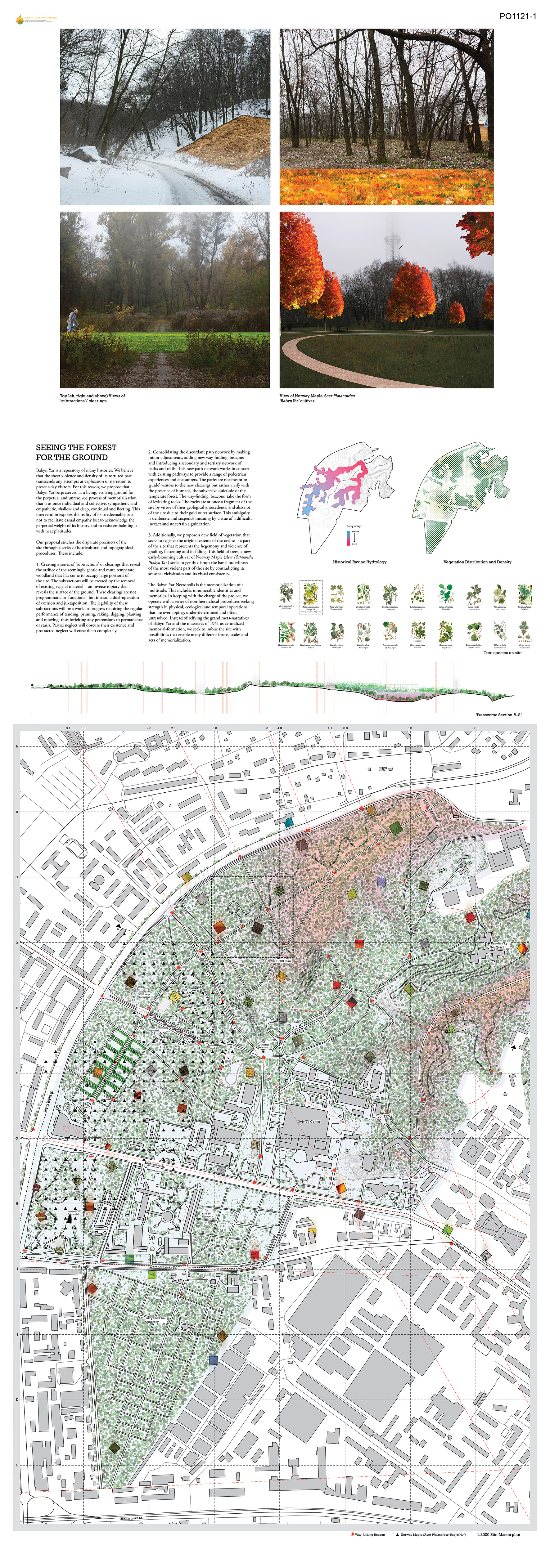
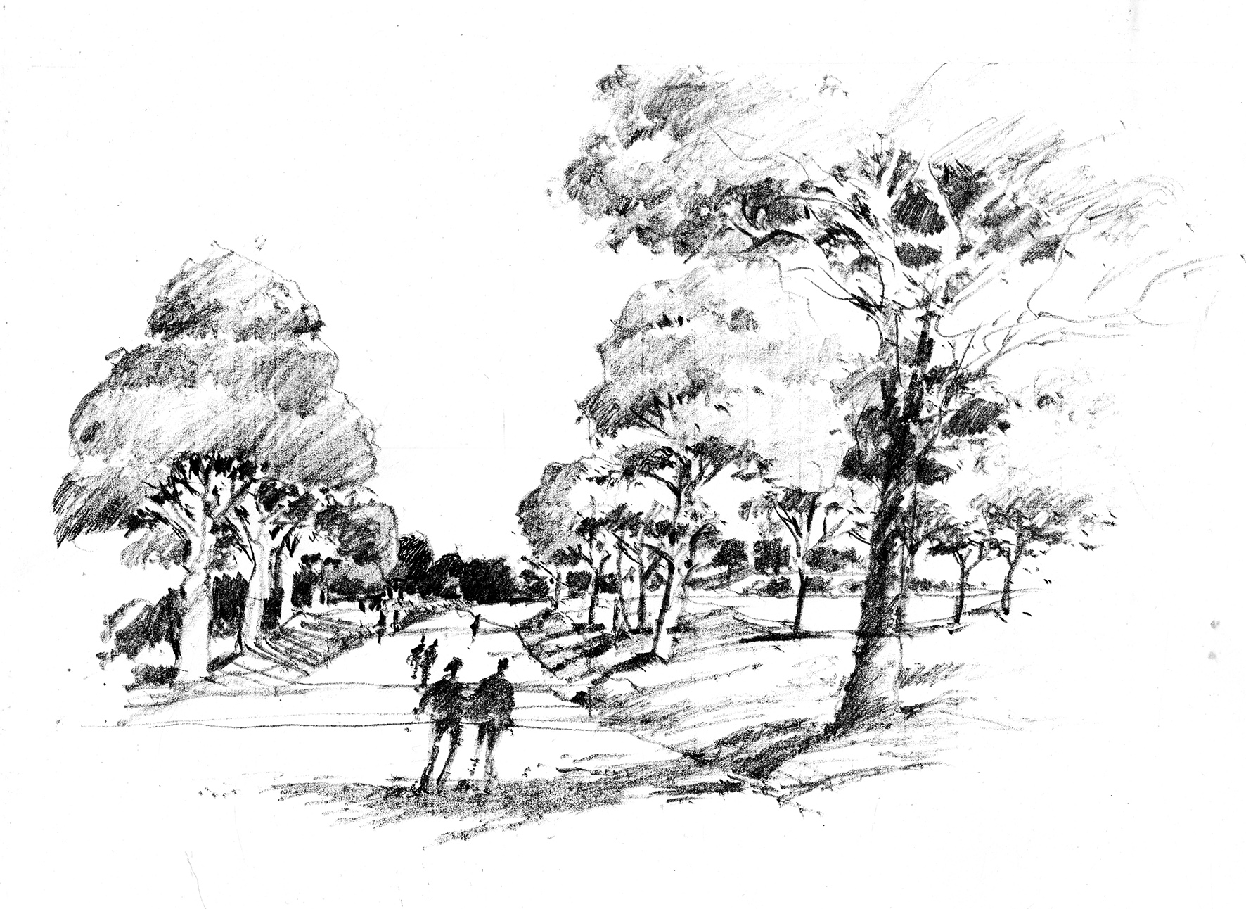
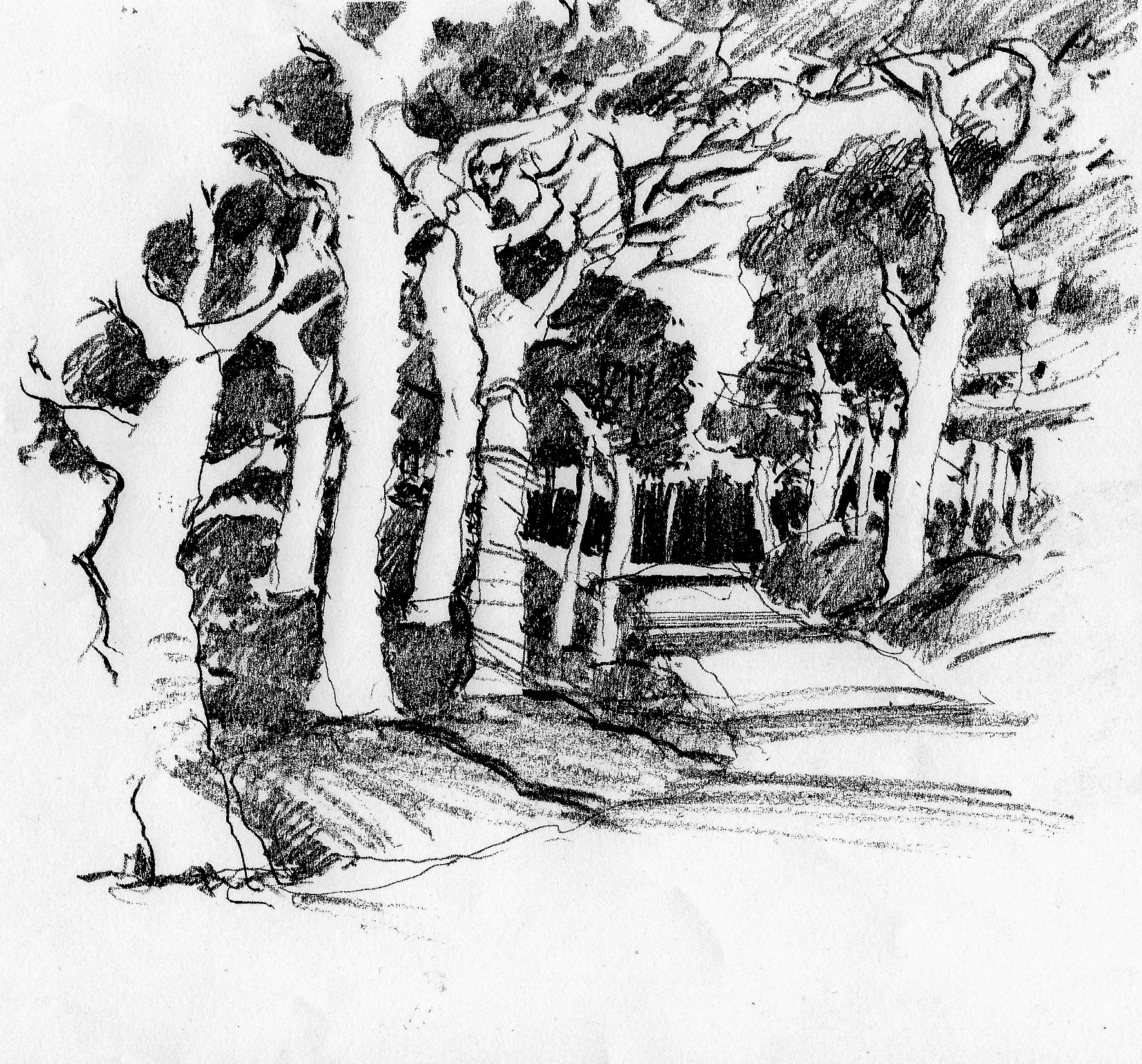
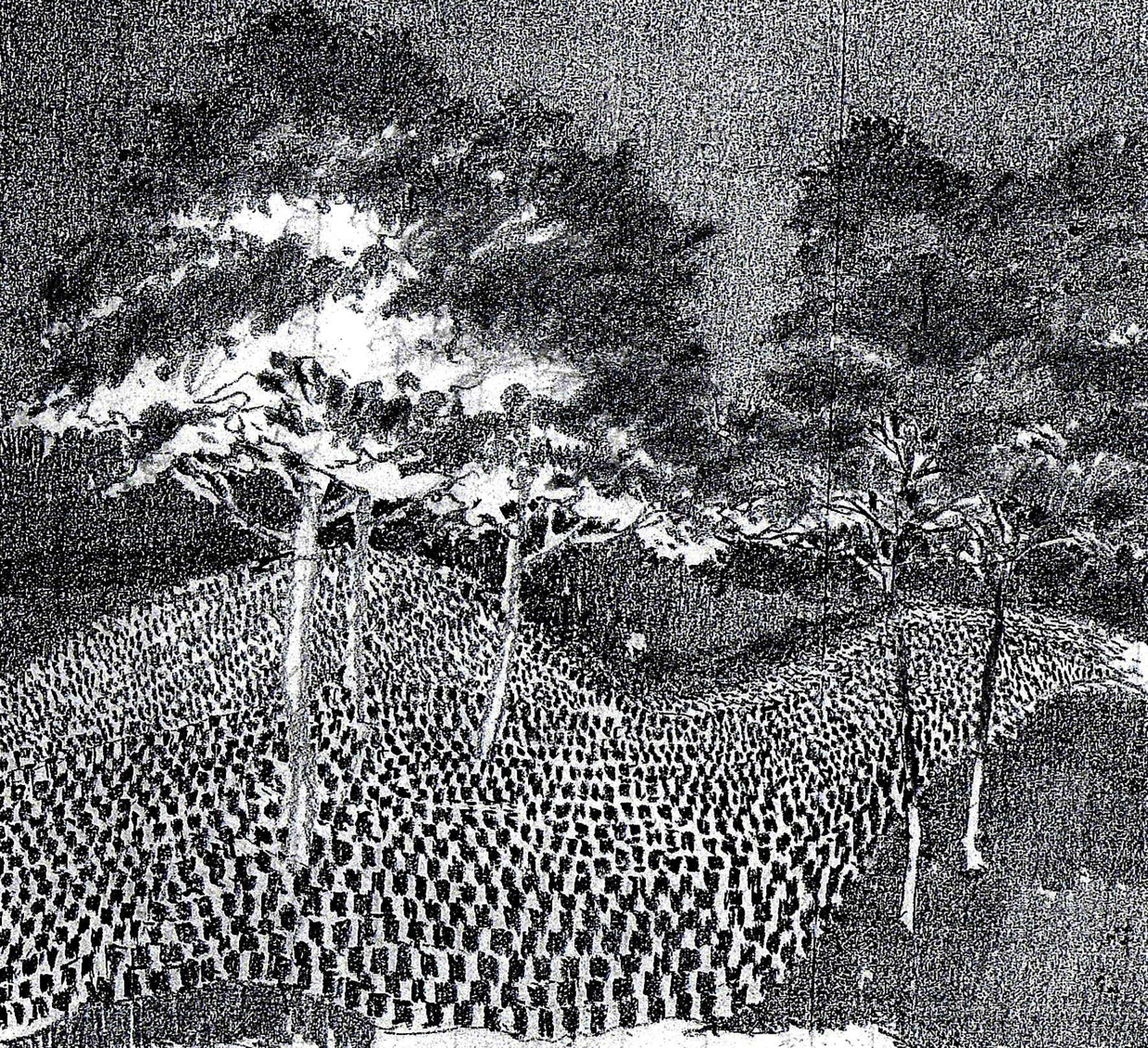
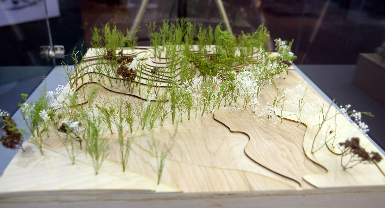
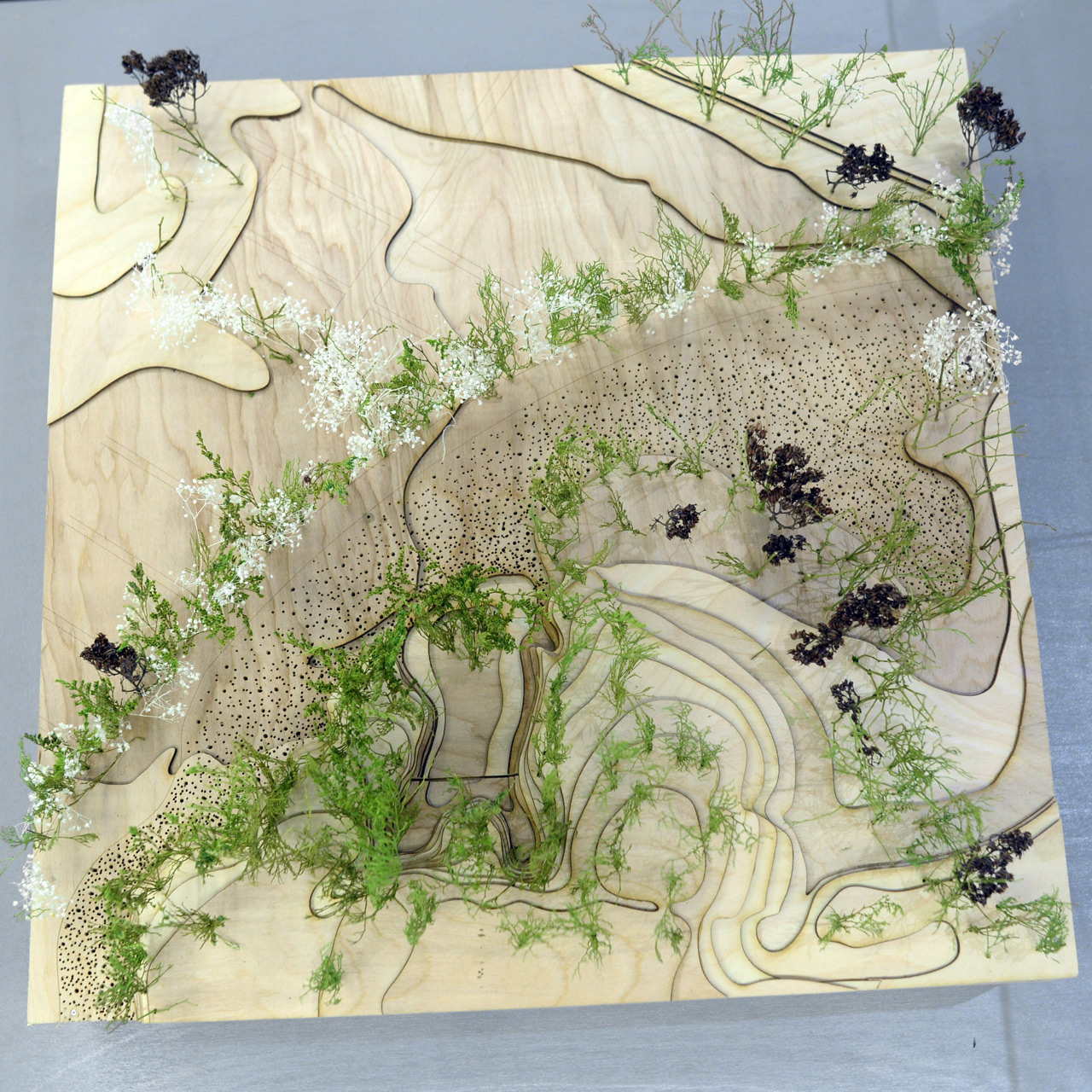
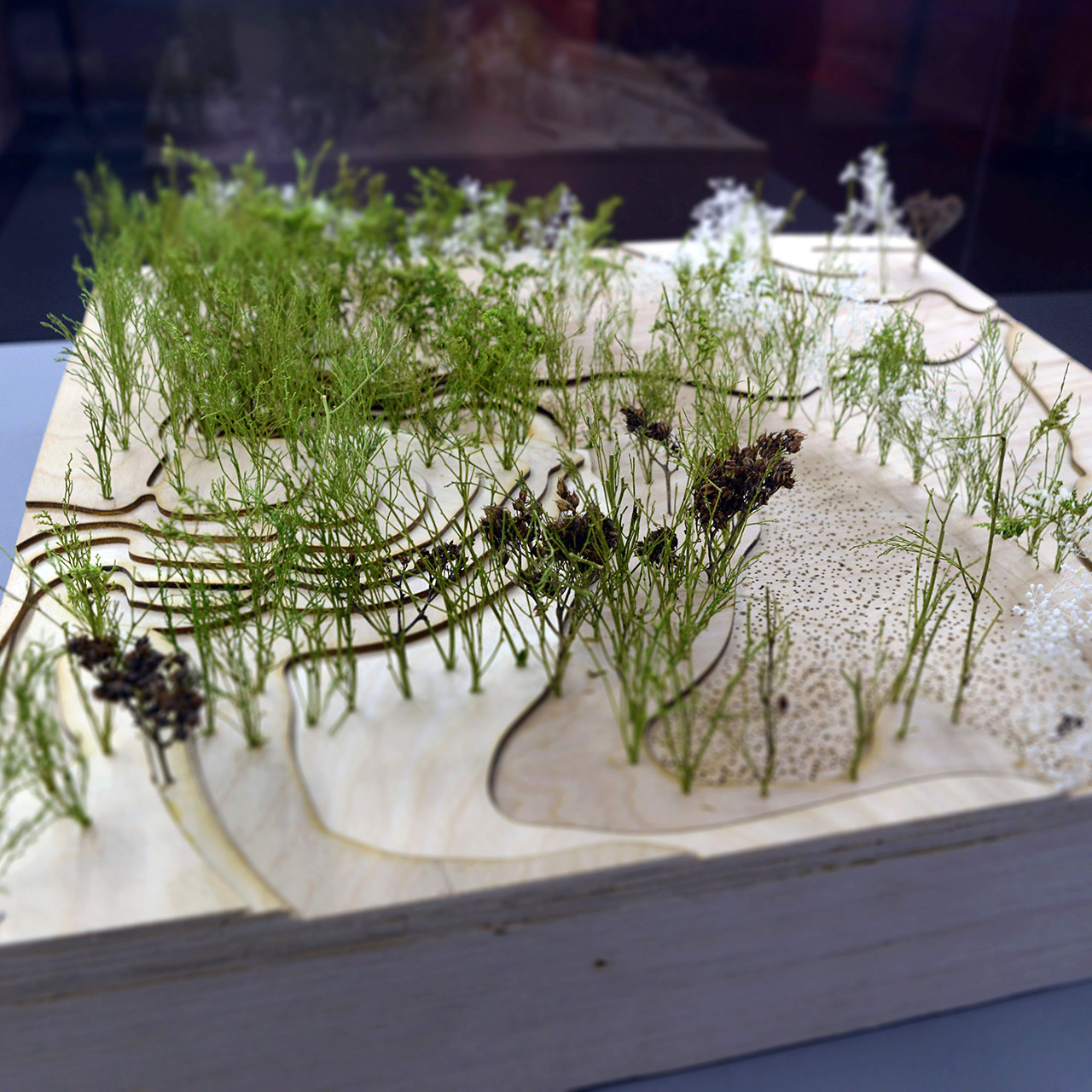
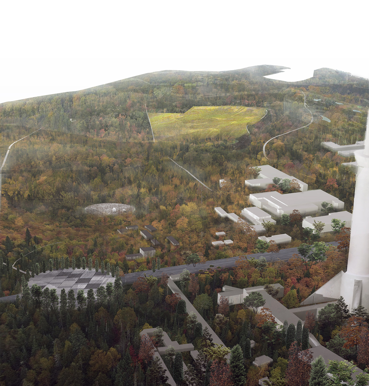
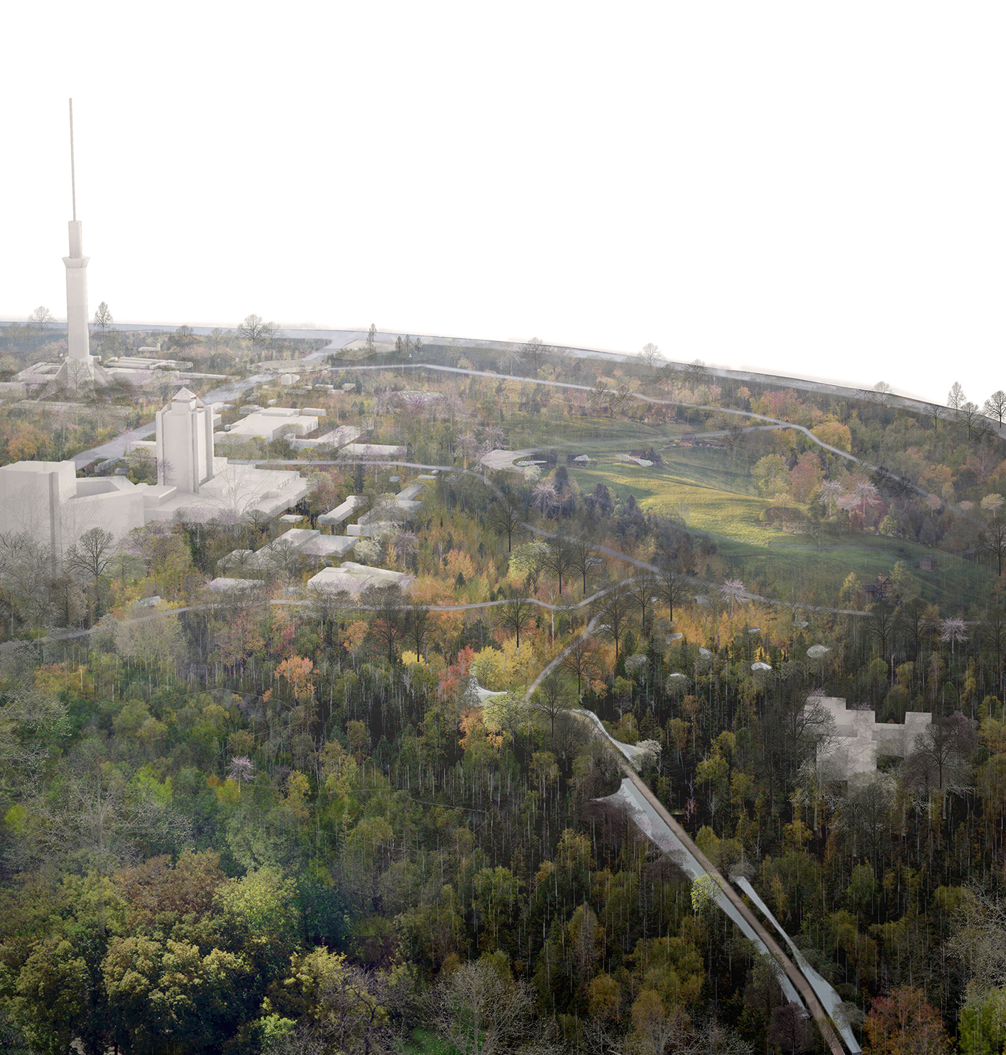
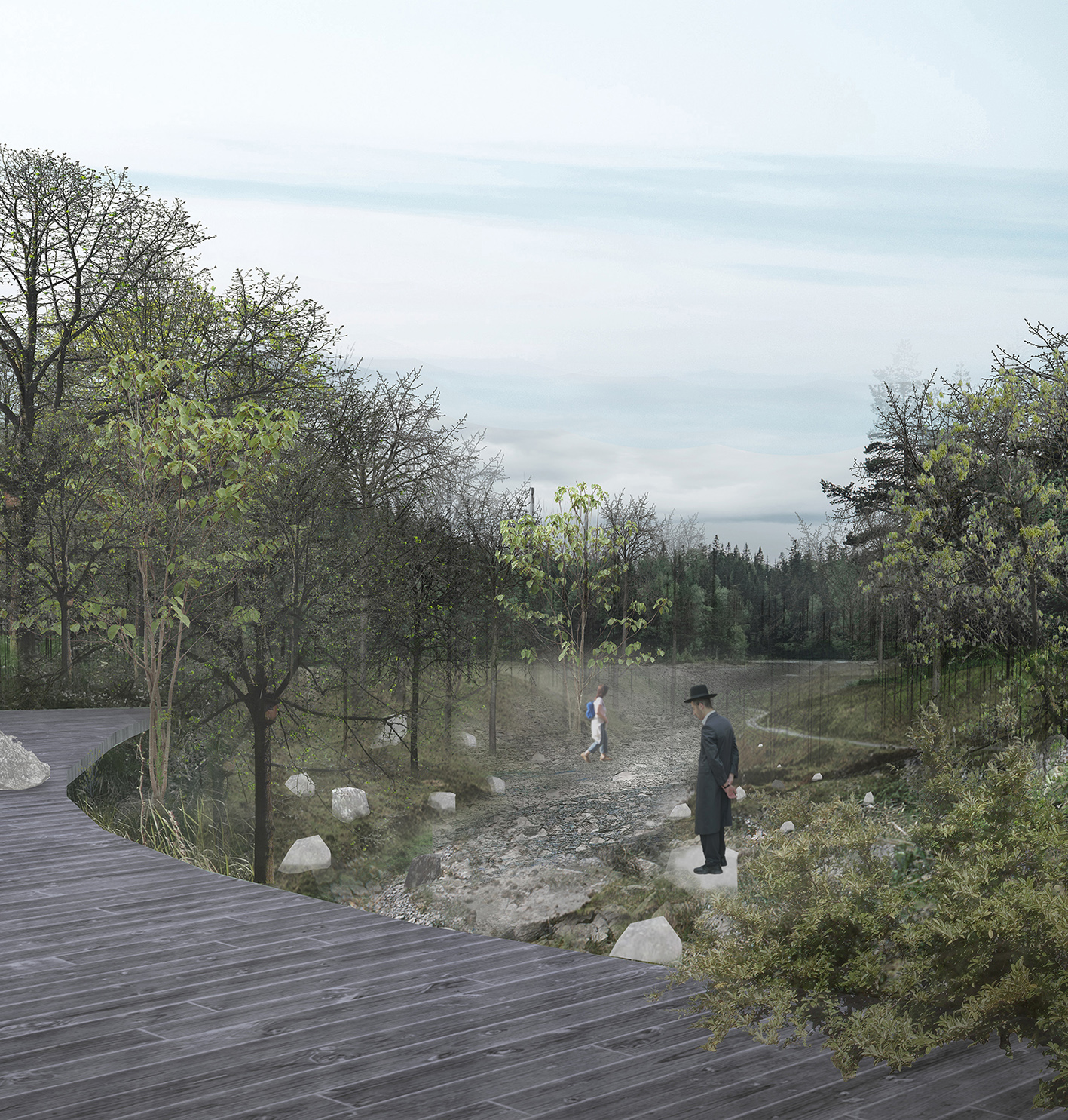
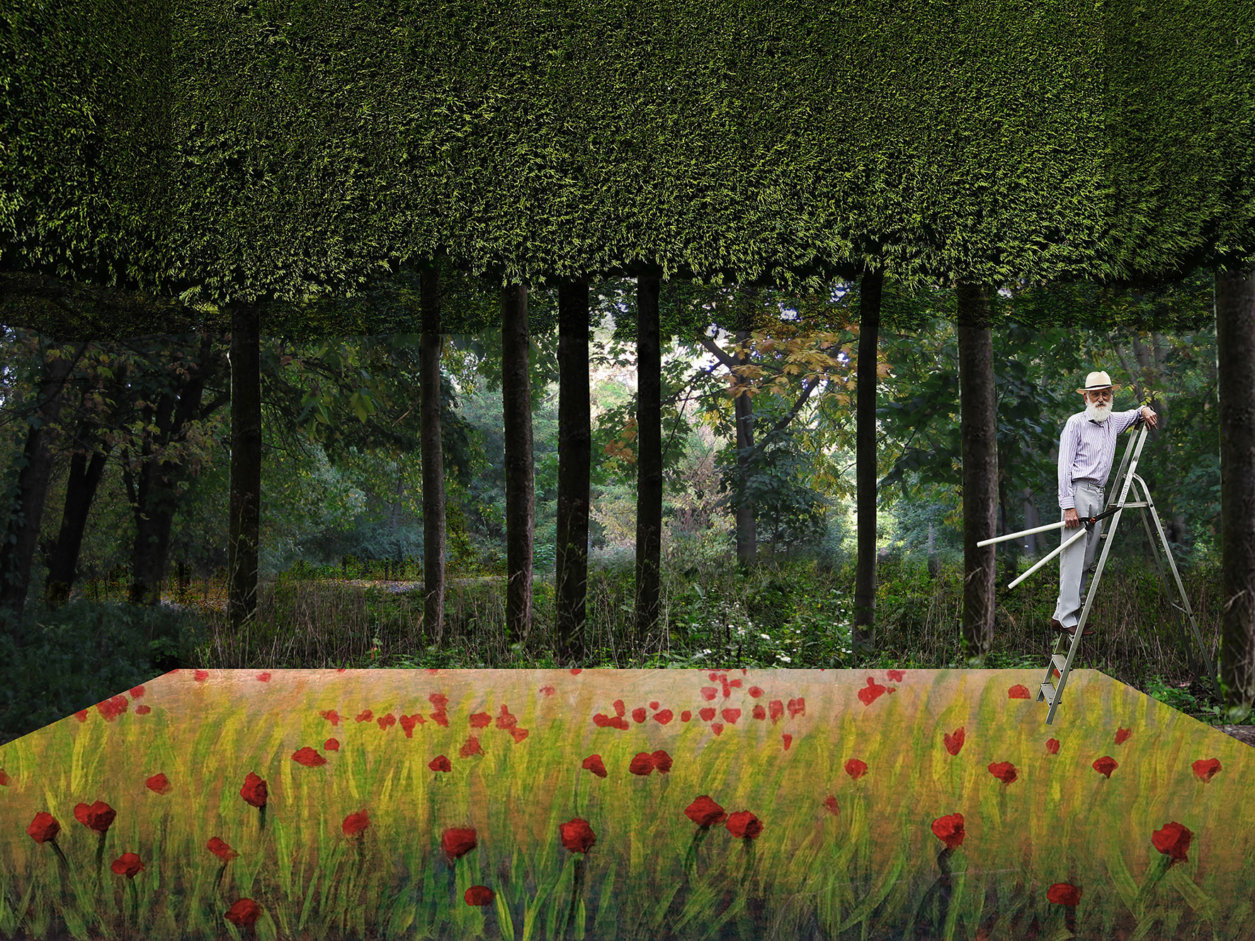
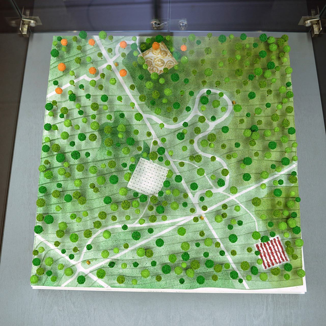
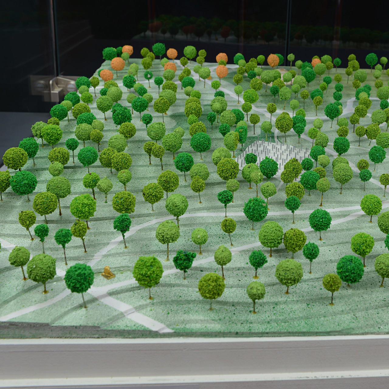
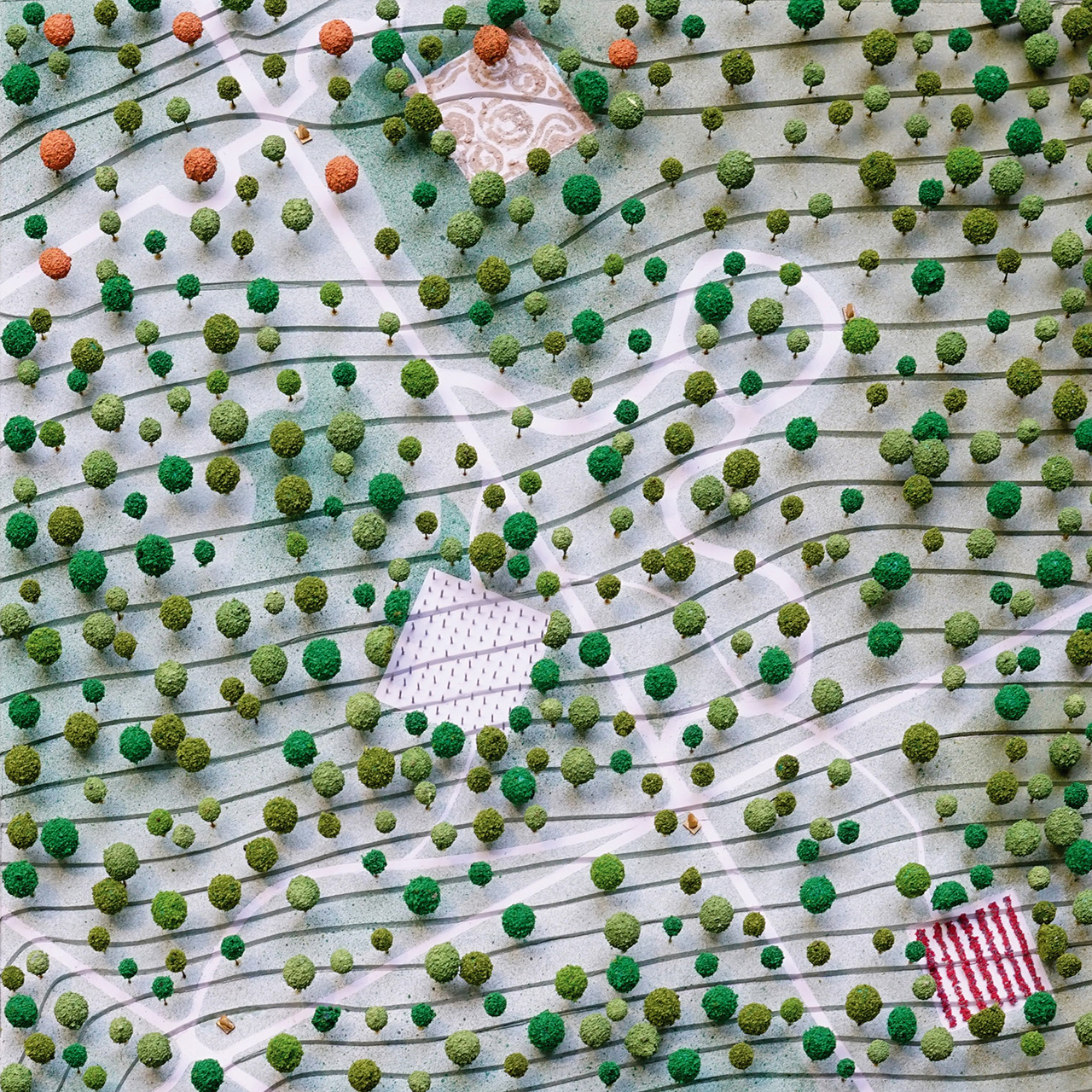
Seeing the Forest for the Ground
Babyn Yar is a repository of many histories. We believe that the sheer violence and density of its tortured past transcends any attempts at explication or narration to present-day visitors. For this reason, we propose that Babyn Yar be preserved as a living, evolving ground for the perpetual and unresolved process of memorialization that is at once individual and collective, sympathetic and empathetic, shallow and deep, continual and fleeting. This intervention exposes the reality of its irredeemable past not to facilitate casual empathy but to acknowledge the perpetual weight of its history and to resist embalming it with neat platitudes.
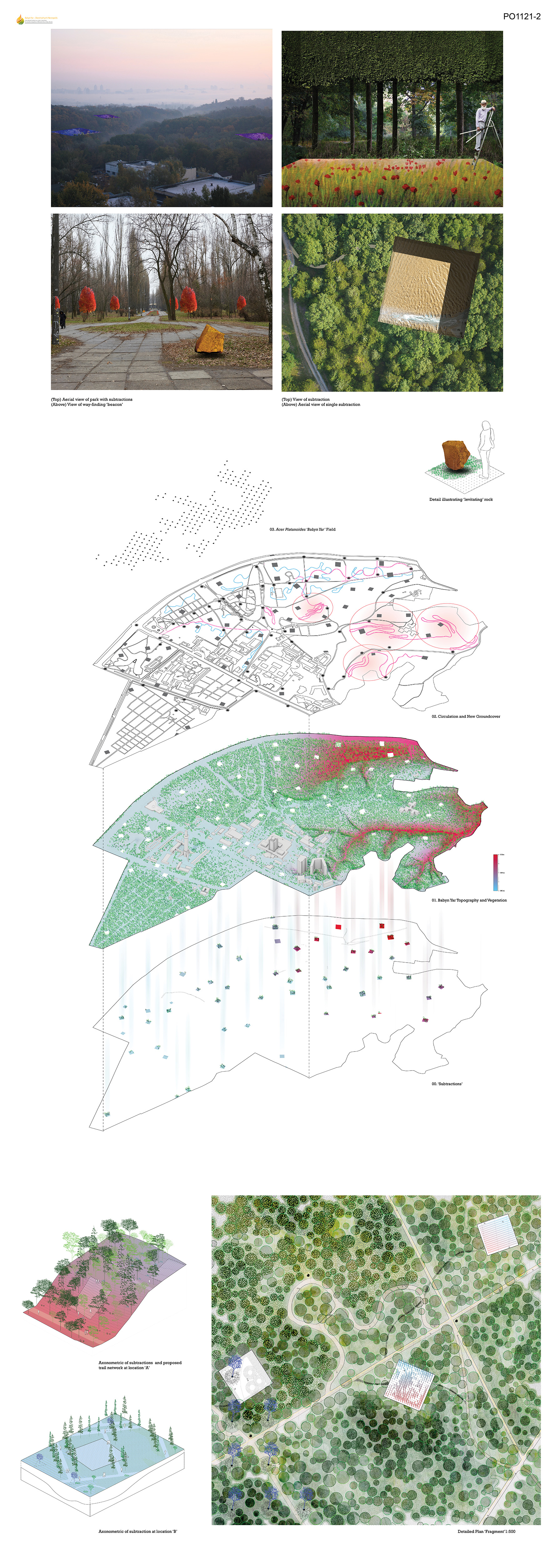
Our proposal stitches the disparate precincts of the site through a series of horticultural and topographical procedures. These include:
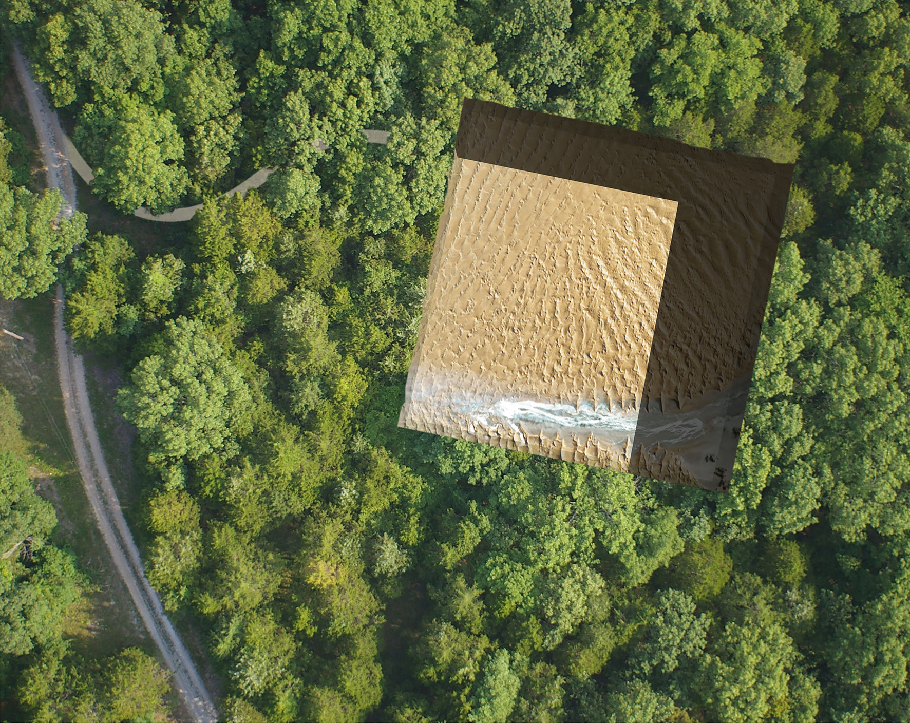
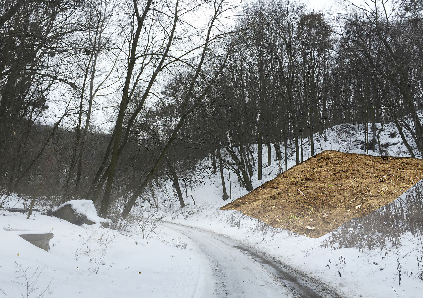
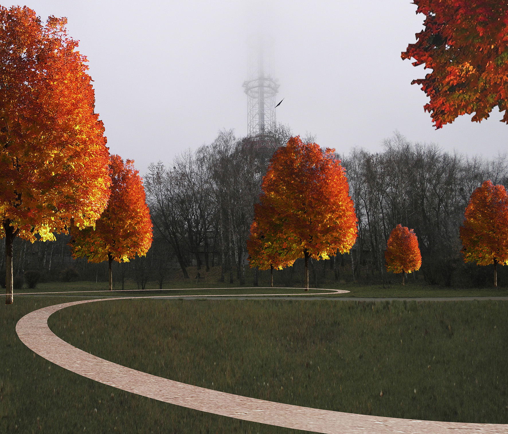
1. Creating a series of ‘subtractions’ or clearings that reveal the artifice of the seemingly gentle and mute temperate woodland that has come to occupy large portions of the site. The subtractions will be created by the removal of existing vegetal material – an inverse topiary that reveals the surface of the ground. These clearings are not programmatic or ‘functional’ but instead a dual-operation of excision and juxtaposition. The legibility of these subtractions will be a work-in-progress requiring the regular performance of tending, pruning, raking, digging, planting and mowing, thus forfeiting any pretensions to permanence or stasis. Partial neglect will obscure their existence and protracted neglect will erase them completely.
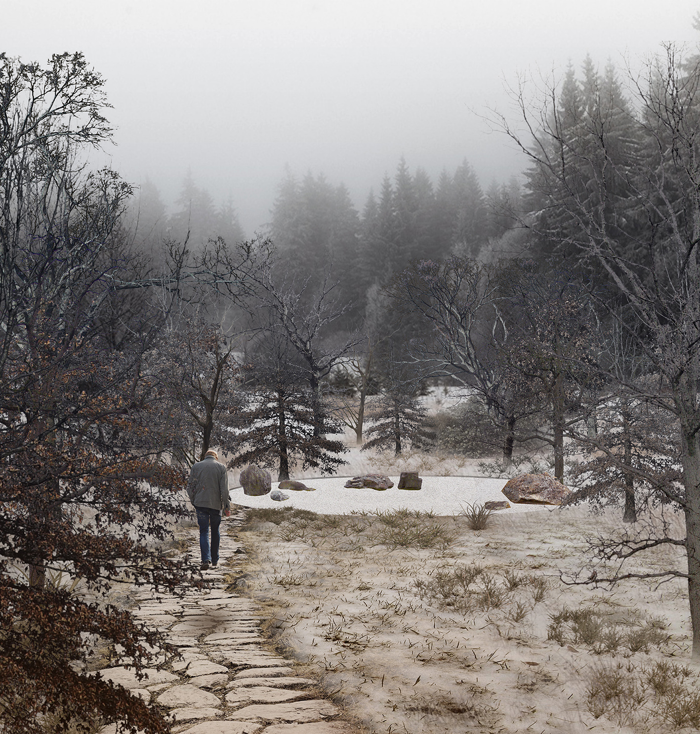
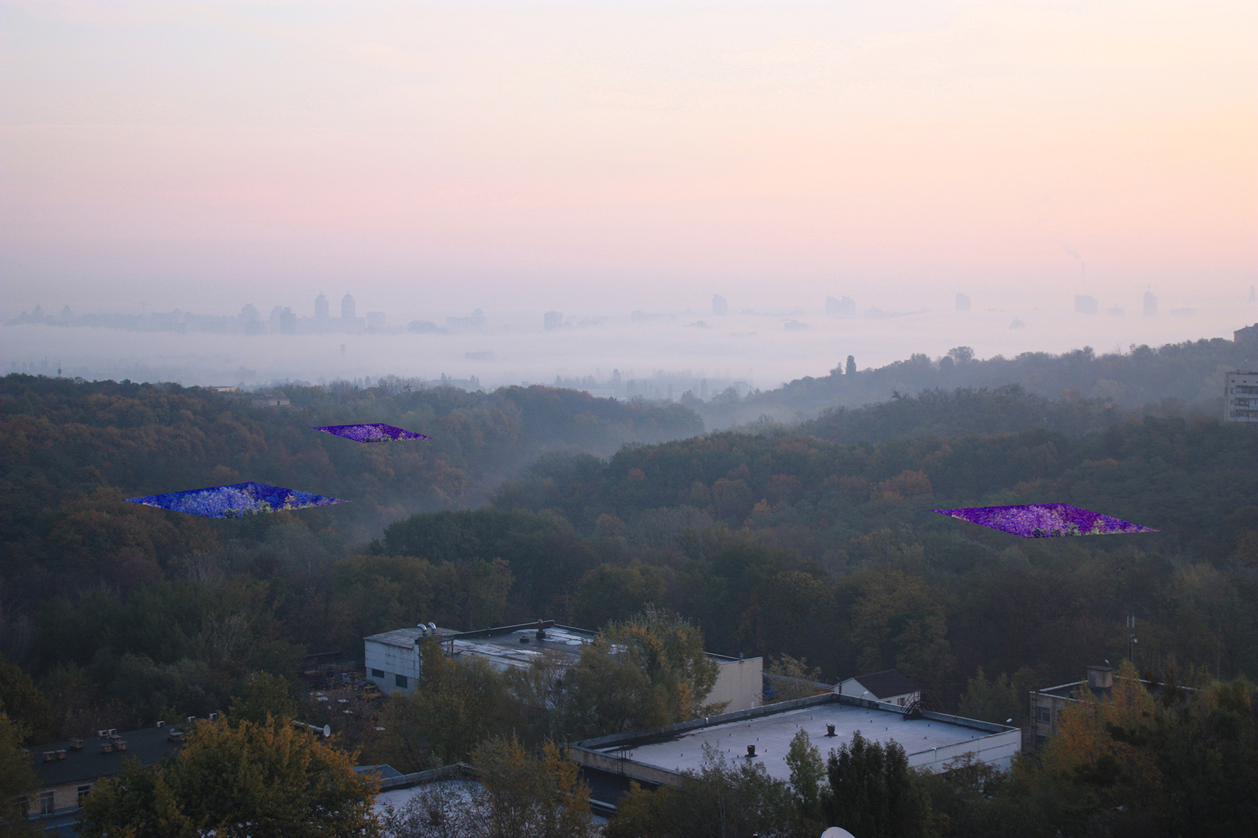
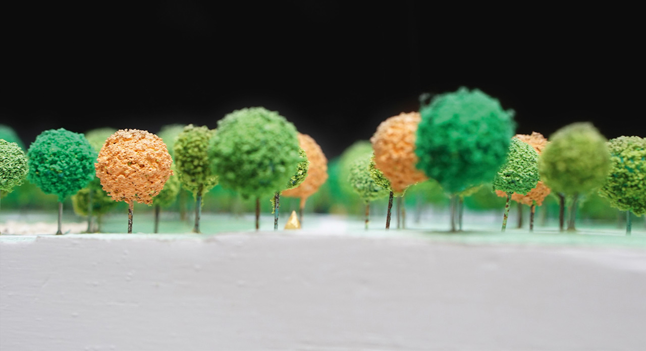
2. Consolidating the discordant path network by making minor adjustments, adding new way-finding ‘beacons’ and introducing a secondary and tertiary network of paths and trails. This new path network works in concert with existing pathways to provide a range of pedestrian experiences and encounters. The paths are not meant to ‘guide’ visitors to the new clearings but rather vivify with the presence of humans, the subversive quietude of the temperate forest. The way finding ‘beacons’ take the form of levitating rocks. The rocks are at once a fragment of the site by virtue of their geological antecedents, and also not of the site due to their gold outer surface. This ambiguity is deliberate and suspends meaning by virtue of a difficult, inexact and uncertain signification.
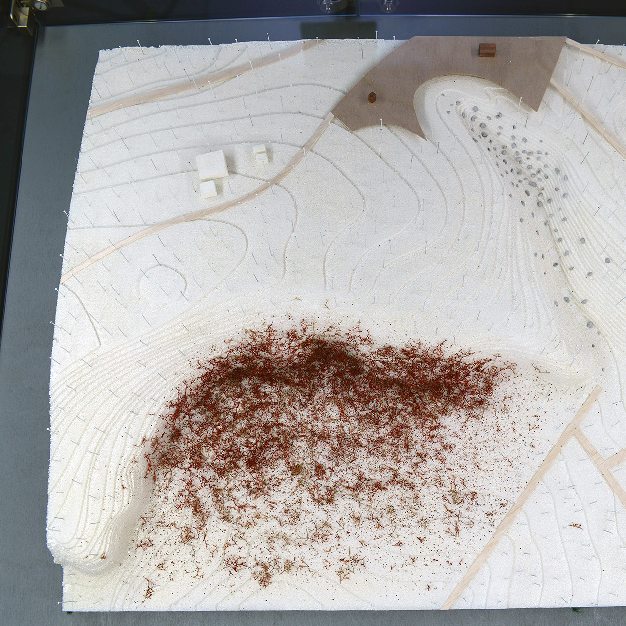
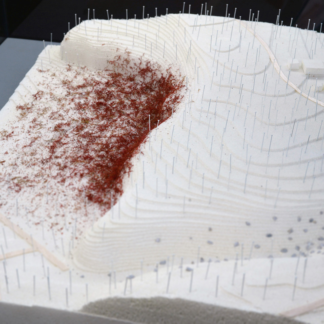
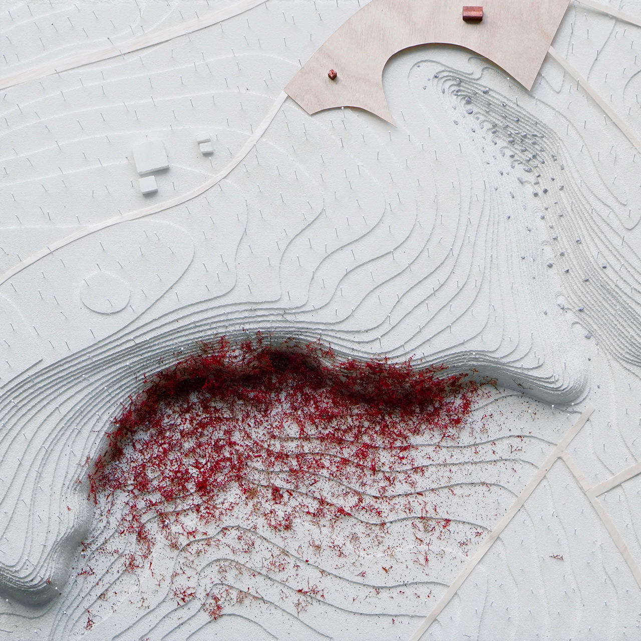
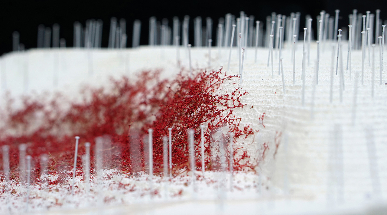
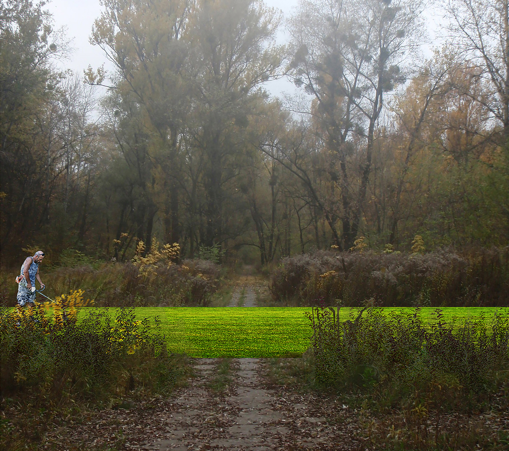
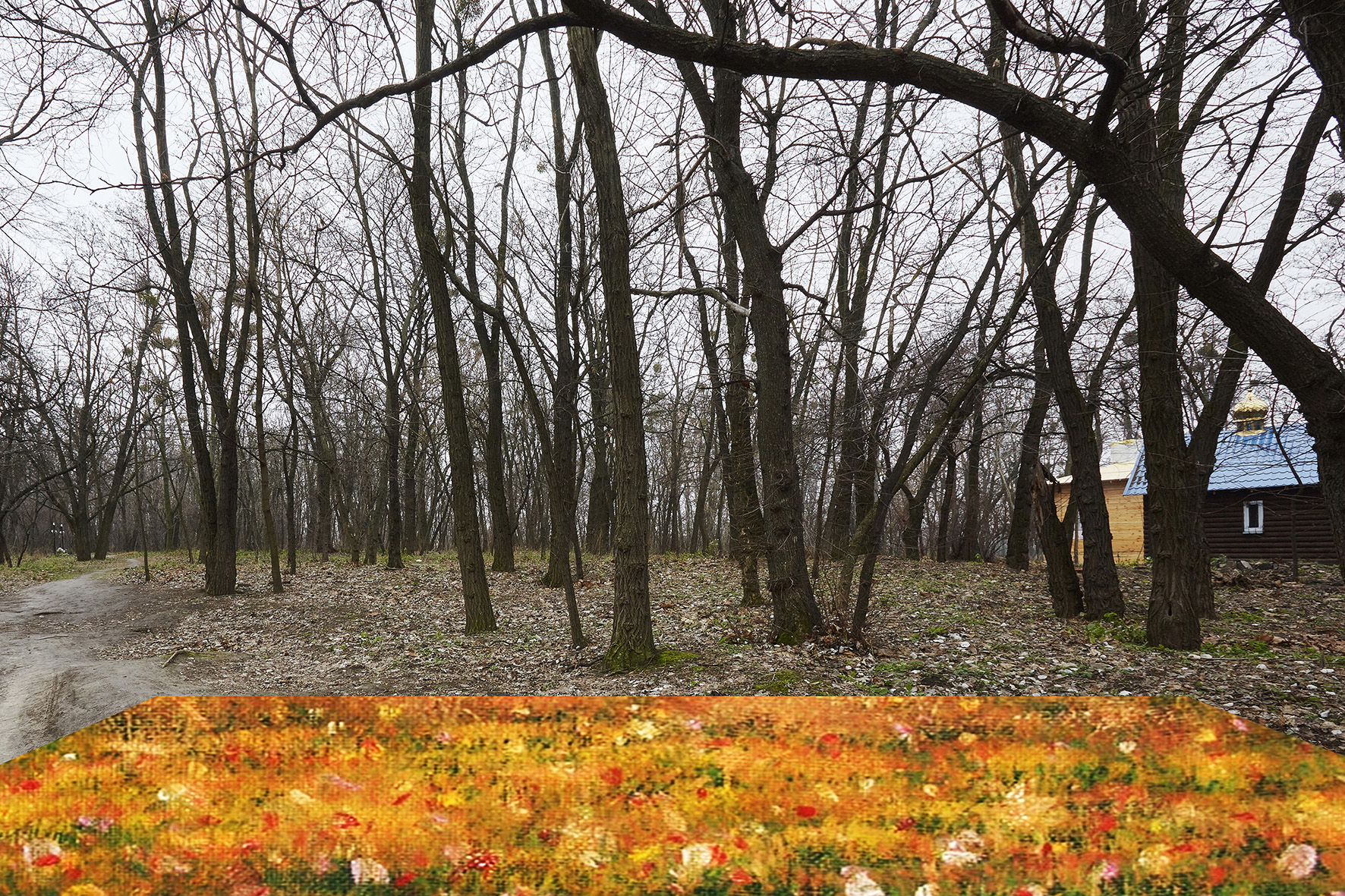
3. Additionally, we propose a new field of vegetation that seeks to register the original extents of the ravine -- a part of the site that represents the hegemony and violence of grading, flattening and in-filling. This field of trees, a new earlyblooming cultivar of Norway Maple (Acer Platanoides ‘Babyn Yar’) seeks to gently disrupt the banal orderliness of the most violent part of the site by contradicting its seasonal vicissitudes and its visual consistency.
The Babyn Yar Necropolis is the memorialization of a multitude. This includes innumerable identities and memories. In keeping with the charge of the project, we operate with a series of non-hierarchical procedures seeking strength in physical, ecological and temporal operations that are overlapping, under-determined and often unresolved. Instead of reifying the grand meta-narratives of Babyn Yar and the massacres of 1941 as centralized memorial-formation, we seek to imbue the site with possibilities that enable many different forms, scales and acts of memorialization.
Autors:
Swarnabh Ghosh — Architect — Gurgaon, India
Khyati Saraf — Landscape Designer — Brooklyn NY, USA
Craig Matthew Rosman — Designer — Brooklyn NY, USA

Model:

Published: 2016-06-07
